Ten days between Bali and Nusa Penida, by scooter most of the time, among hidden waterfalls, rice terraces overrun by Instagram and an unexpected encounter with manta rays. A solo trip, punctuated by unlikely reunions with faces met on the very first day — and an ending somewhat rushed by a phone call from far away.

Day 1

Arriving in Bali, first steps in Padang Bai

Out of the airport around 2:30 p.m., hassled by taxi drivers from the very first steps. A tout points me toward what he presents as the “public bus” — actually his own minivan — with a price that tumbles from Rp 900,000 to Rp 400,000 in a few seconds of haggling. Still too expensive. I walk a little and run into two backpackers, Jules and his girlfriend Christelle, a Swiss guy and a French woman. They had also been looking for a bus without success, and explain that they plan to order a Grab instead — a word that means nothing to me at the time; the Asian equivalent of Uber, as they sum it up. They show me where they’re headed and offer to share the ride. Looking at their route, I notice that Padang Bai is on the way: a port village I’d vaguely heard of, the departure point for ferries and speedboats to Nusa Penida, Nusa Lembongan, the Gili Islands and Lombok. The perfect opportunity to stop there and make it my base: rent a scooter, explore the island as I please with no fixed itinerary, and maybe push on later if I feel like it — to other islands, without knowing yet which ones.

The driver arrives and, once on the road, explains why: at the time, it was impossible to order a Grab directly from the airport, since local taxi drivers saw it as unfair competition, to the point that it had already led to real tensions, sometimes fights. Two hours on the road, shared three ways for Rp 250,000, and a bit of chatting — he’s looking for a job as a diving instructor, she’s following him on his wanderings. In Padang Bai, the driver first drops Jules and Christelle at their place, then takes me to mine: a hostel at Rp 115,000 a night, breakfast included. Little sleep on the plane: I collapse at 7 p.m.

Day 2

An endless wait and the road to Ubud

Awake at 4 a.m., then dozing until 7. Lots of people at the hostel are leaving for the Gili Islands; for my part, I first want to rent a scooter to explore Bali, with the idea of maybe coming back this way later for a possible crossing to Nusa Penida, nothing certain — but every scooter rental place around insists on keeping my passport as a deposit, out of the question for five days. So it’s the bus to Ubud. In the meantime, I go and kill some time at Blue Lagoon, a quiet cove but with rough sea: snorkeling doesn’t last long, poor visibility and too much current to venture far from my things, left unattended.

Back at the meeting point, where the bus is supposed to leave as soon as a boat arrives from the Gili Islands — a globe-trotting Australian waits with me. The guy from the agency, meanwhile, spends his time laughing with his taxi-driver buddies parked right next to us, serving us at regular intervals a “leaving soon” that sounds less and less convincing. The minutes pile up — 45, then a full two hours of waiting — during which he doesn’t hold back from suggesting, like a not-so-subtle salesman, that a taxi (one of his pals’, as luck would have it) would surely be faster. Hard to know, looking back, whether that boat was really late or whether the whole wait was just a way to make us crack. We don’t give in, despite the pressure. The minibus finally shows up, a good two hours after the announced time — we finally get on. An hour and a half on the road later, I get off in Ubud and set out on foot to find somewhere to stay. I find Phostel, tucked away in a lane near the market: Rp 150,000 a night, spotless dorm, breakfast included, a nice little rooftop. Bed.

Day 3

Waterfall after waterfall, all the way to a fever

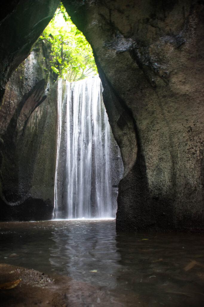
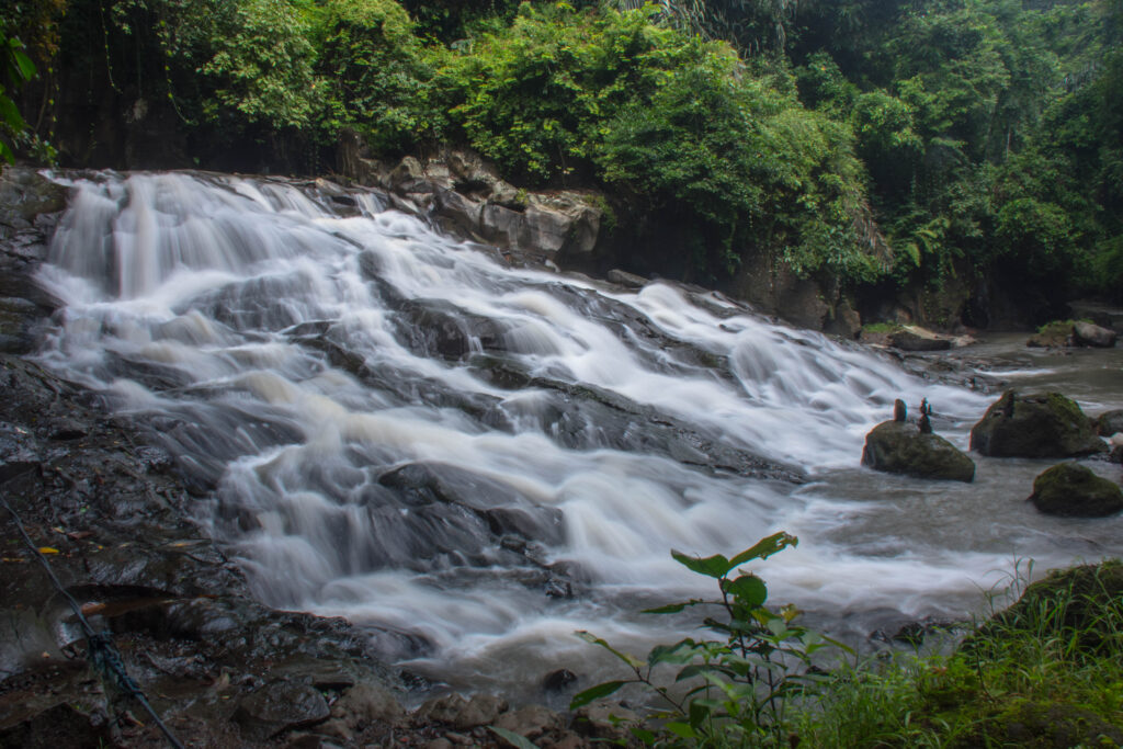
I rent a scooter at the hostel for Rp 60,000 for the day and set off to discover the waterfalls: Tibumana, Goa Rang Reng, then Tukad Cepung — all pleasant, without being breathtaking. The last one, Tukad Cepung, is clearly the most spectacular, reachable only by walking through a small cave with your feet in the water. Not many people there, but enough for a queue to form in front of the falls, everyone wanting their photo with nobody else in the frame. Really nice spots, but each time the access is somewhat “developed” — stairs, marked paths — which no doubt explains why none of them is free: taken one by one, the entry fees (a few thousand rupiah each time) seem trivial, but the bill ends up adding up across three sites in the same day.
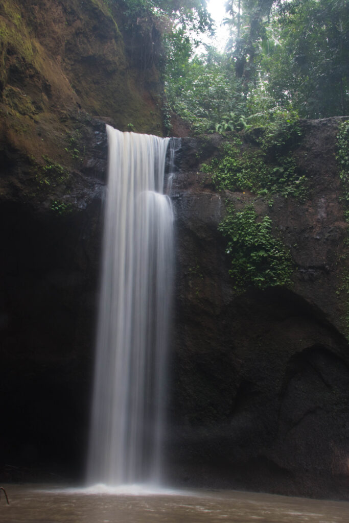
The day alternates between showers and sunny spells, and the scooter ride back is no exception: soaked by the rain after sweating all day on the stairs in full sun, that hot-and-cold combination probably doesn’t help. I get back to the hostel feeling under the weather — no appetite — and go to bed feverish, without managing to fall asleep.

Day 4

A thieving monkey and rice terraces that are too touristy

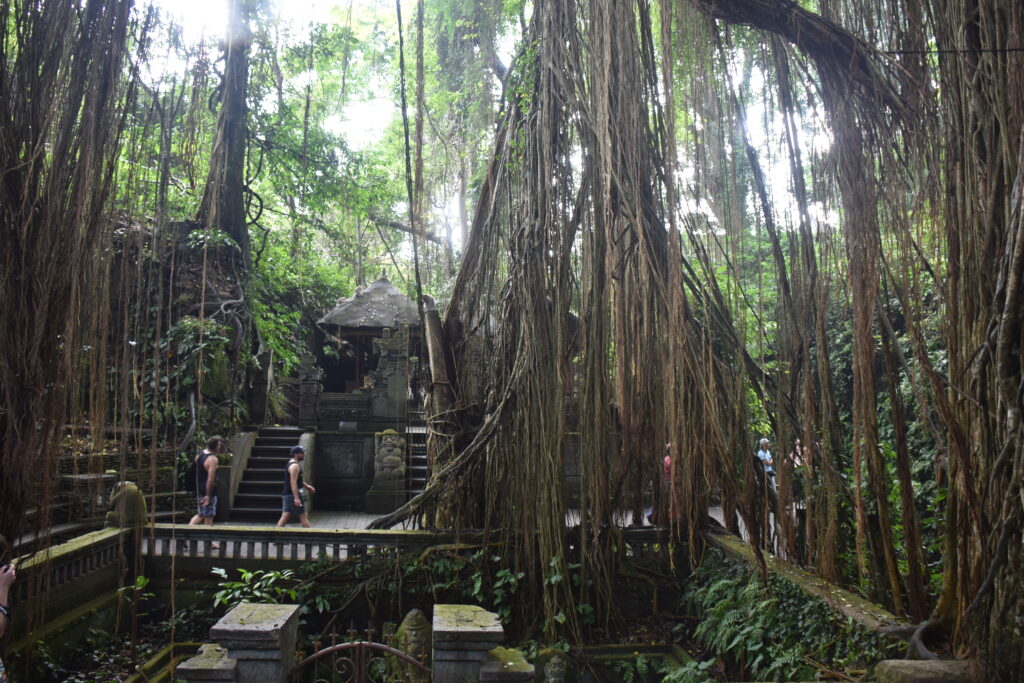
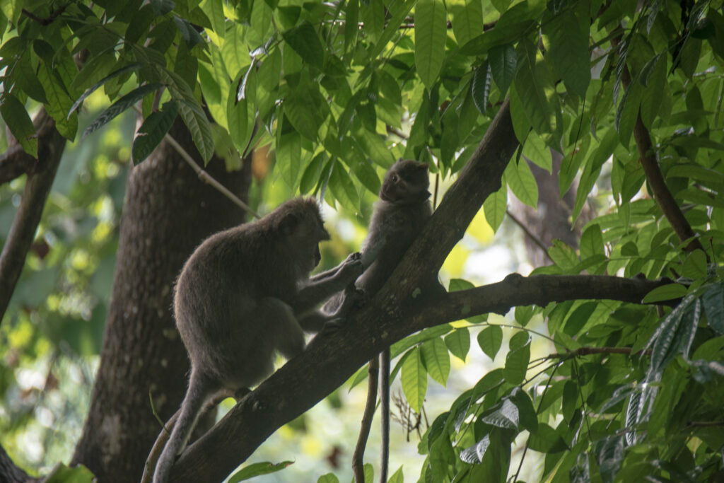
Not exactly in great shape when I wake up, after last night’s fever. Off to the Monkey Forest, a stone’s throw from the hostel (Rp 60,000 entry) — exotic all the same, between the mossy temples overgrown with vines and the macaques strolling around as if they owned the place, but an exoticism that feels a bit staged: here, the monkeys are clearly looked after for the show, to the point that you can pay a guard to pose with them. One of them takes it upon himself to remind me who’s in charge here: he literally climbs on me, grabs my bag and pulls with all his might to try to snatch my 1.5-liter water bottle. Luckily it’s too heavy for him — I take off the bag, monkey still hanging from it, and wait, as unfazed as possible, for him to finally let go.
The urge to see something else then sends me on the road to Mount Batur, by scooter, an hour and a half through constantly changing landscapes — rice fields, then steeper and steeper slopes. Climbing to the summit, however, also comes at a price; so I settle for admiring the volcano from the road, its silhouette half drowned in clouds that day. On the way back, a scene stops me in my tracks: a funeral procession crosses the road, the deceased carried in a coffin on a bamboo platform, the whole procession in traditional dress. They’ll walk like this for more than ten kilometers, including a formidable climb — probably a ngaben, the great Balinese Hindu cremation ceremony, though I didn’t get the chance to learn more about it on the spot.
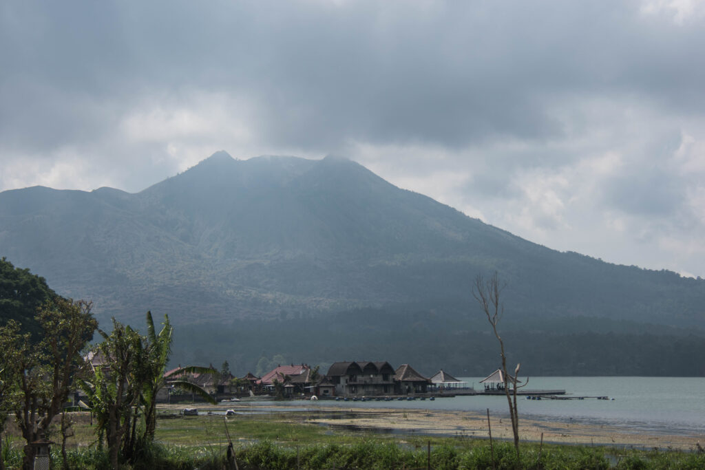
Mount Batur under the clouds, with its lake at the foot of the volcano
Mount Batur

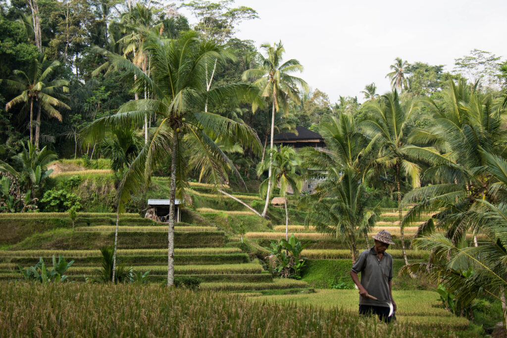
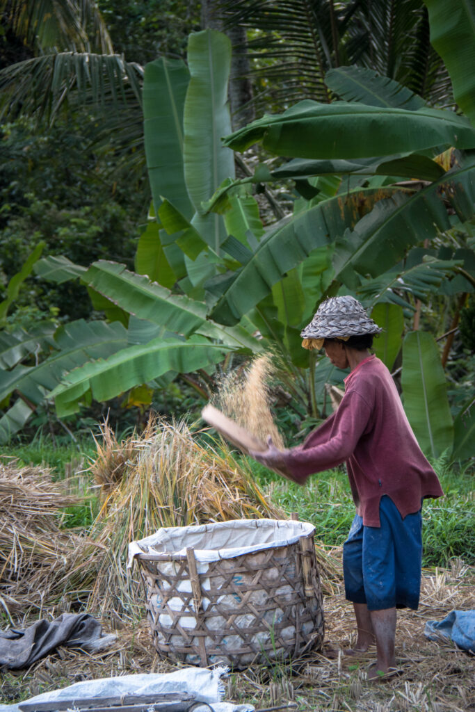
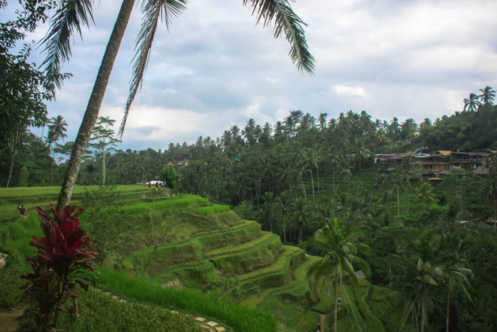
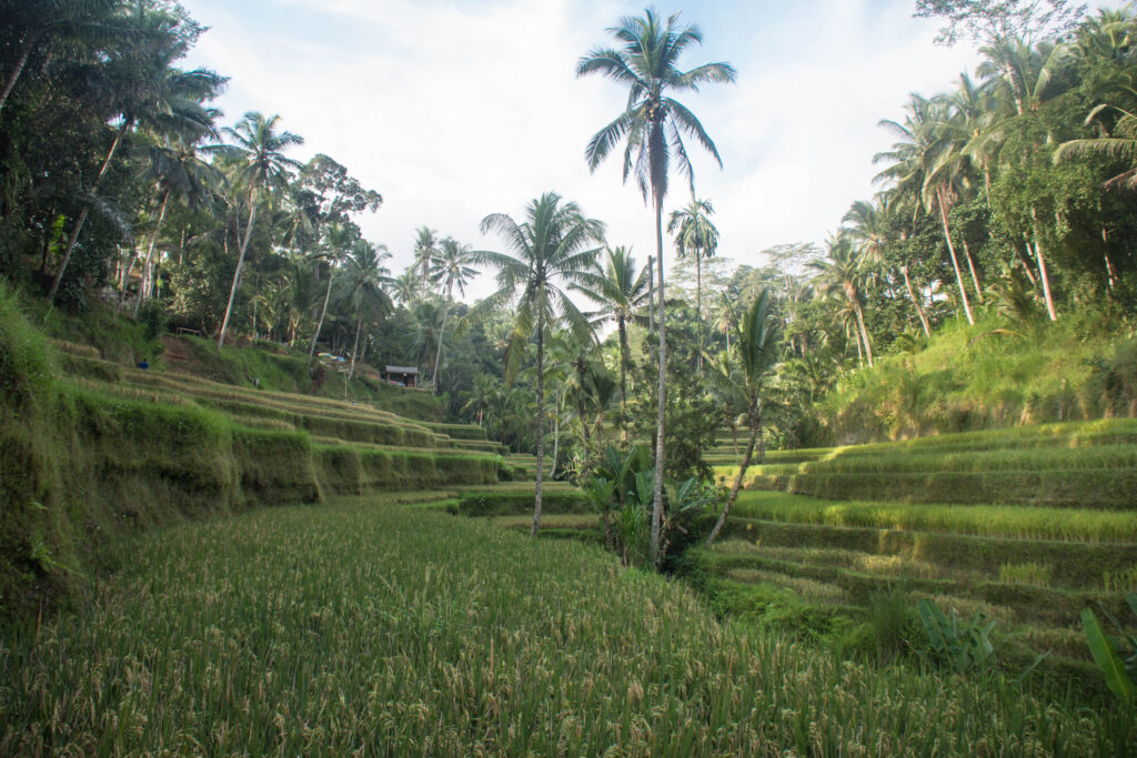
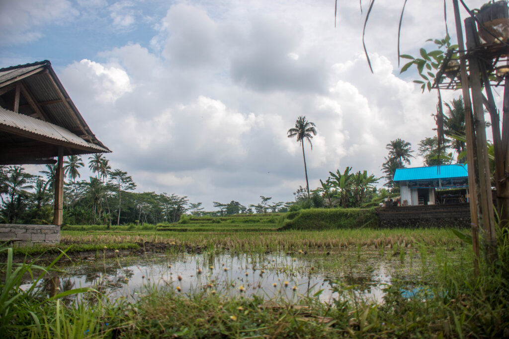
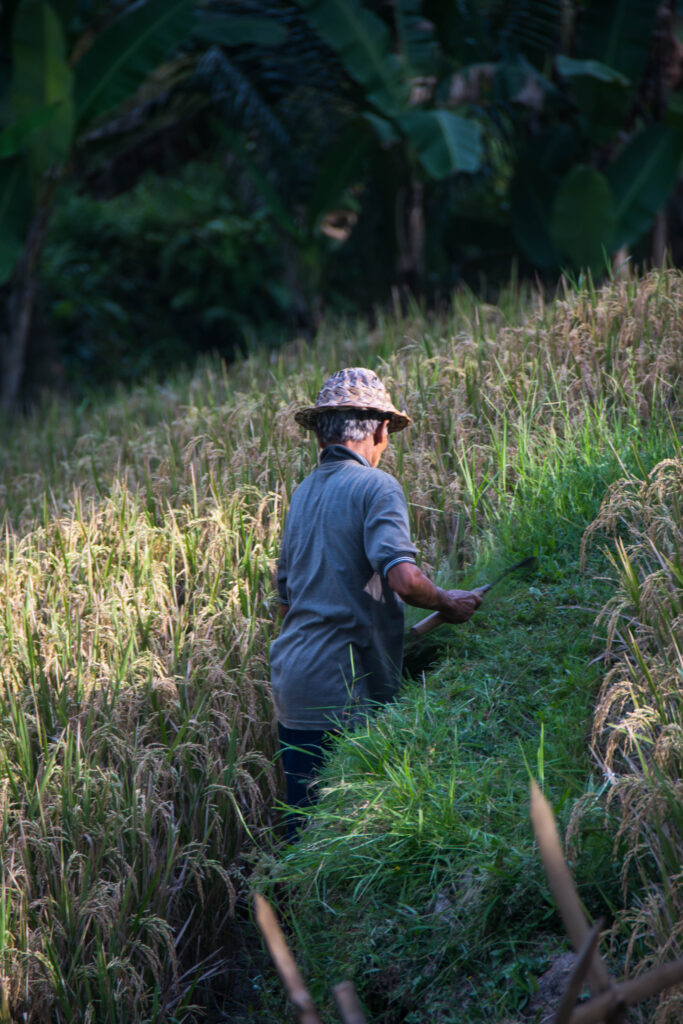
Still on the way back, a last stop at the Tegallalang rice terraces — and here, the contrast is brutal. Gone is the relative calm of the rest of the day: here, everything seems designed for Instagram. Giant swings hanging over the void (probably outrageously expensive; I didn’t even go near them to check), droves of tourists taking turns at every viewpoint, and above all that string of “donations” at every new plot you cross — presented as voluntary, demanded like a toll as soon as you try to pass without paying. I end up giving in, less out of conviction than to be left in peace. On the main paths, the staging continues: fake rice farmers, traditional tools in hand, offer to pose for a few coins — the kind of moment that leaves a slightly bitter taste. A good twenty minutes of waiting later, while two aspiring models finish their never-ending photo shoot, I finally find a quiet spot for my own. But pushing farther, where the crowd thins out, the scenery changes completely: real farmers are busy in the rice fields, getting on with their own work, asking nothing of anyone — a real breath of fresh air after that whole circus. Back to Ubud, dinner and a beer shared with other travelers at the hostel.
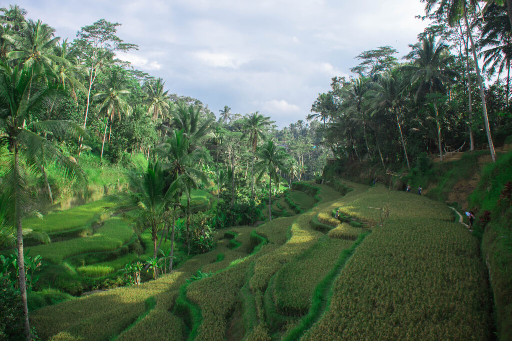
Tegallalang rice terraces surrounded by coconut palms
Farmer in a straw hat working in a rice field at Tegallalang
Tegallalang rice terraces and coconut palms, with a farmer in the foreground
Farmer threshing sheaves of rice over a basket at Tegallalang
Valley of Tegallalang rice terraces under the palm trees
Lush green rice terraces and tall palm trees at Tegallalang
Day 5

A floating temple on Lake Tamblingan

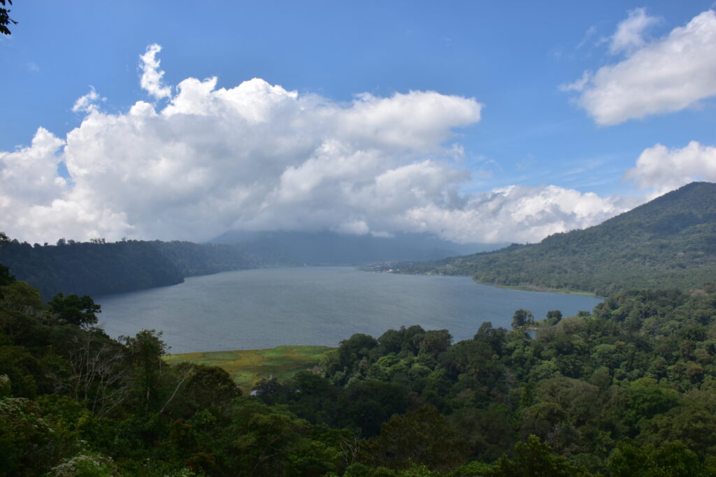
A coin toss decides it, because of uncertain weather: off to the Twin Lakes. The road, magnificent, winds through rice fields and small villages before climbing in hairpin bends lined with monkeys. After a cloudy viewpoint and a much more damaged stretch of road, I reach Lake Tamblingan — the smaller of the twin lakes, but also the least visited. Everything costs money, no surprise there (Rp 25,000 entry, and no trekking on your own: you need a guide, Rp 350,000 for an hour and a half). I settle for the basic entry, which is more than enough: a temple that seems to float a few meters from the shore, a silence broken only by birds and insects. A man comes over, offers a boat ride (Rp 100,000, declined), then comes back just to chat — he explains that the water level can vary by two meters depending on the season, and that you can also reach the temple on foot. Back to Ubud by the same road, busier at this time of day.
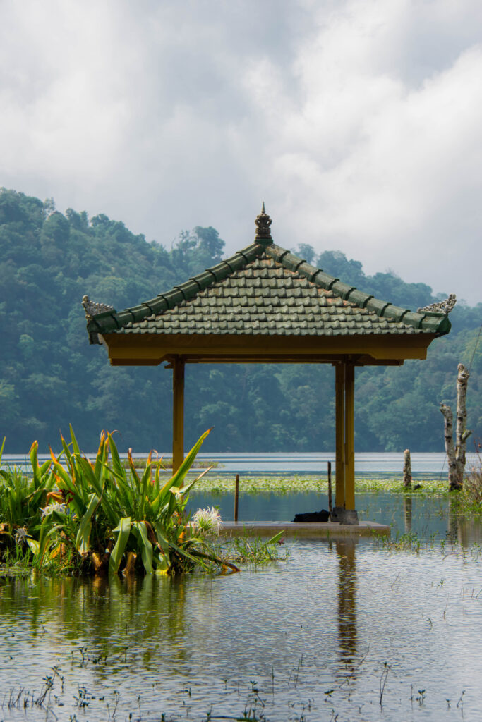
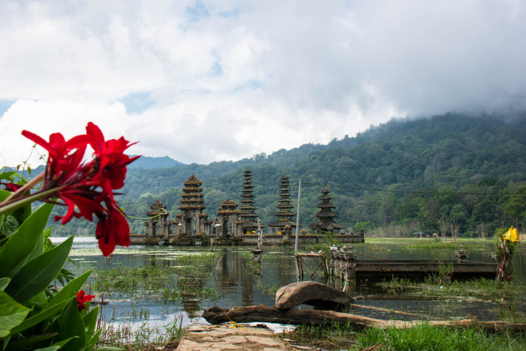
Balinese pavilion standing on the water of Lake Tamblingan
Temple that seems to float on Lake Tamblingan, red flowers in the foreground
View of the twin lakes surrounded by forested hills
Day 6

Ferry and scooter hassles on Nusa Penida

A quiet morning, a quick look around the market while waiting for the 12:30 p.m. bus to Sanur — the obligatory gateway to Nusa Penida, an island off the south of Bali that can only be reached by boat. Once there, no regular ferry as the hostel had said, only speedboats at Rp 200,000. On arrival at Nusa Penida’s port, a surprisingly calm atmosphere.

At the port, a first “rental agent” approaches me — actually just a guy who seems to be renting out his own scooter, with no shop or address to return it to, and no helmet either. Not very reassuring: I decide to look elsewhere. Walking on, I come across a homestay that also rents scooters, looking a bit more official — but still no helmet in sight. The woman there tells me with a smile: “No police here.” Apparently nobody wears a helmet on this island. I think I catch a glimpse of Christelle and Jules on the way — the same Swiss and French travelers I met on the very first day at the airport.

Off to Sampalan to find a hostel. The lady at reception isn’t sure she has room, leafs through her ledger muttering “180”; I try, laughing, “can you go down to 150?” — she smiles and whispers “okay, but shh, the boss is right next door.” With the dorms full, it’ll be a small room behind the main hall, two small beds and a fan — more than enough. A message exchanged with Jules in the meantime: confirmed, they’re on the island. Dinner out together. Back at the hostel, I’m sitting in the hall for a bit when a girl turns up: “There’s someone sleeping in my bed…” Since I happen to have two beds in my room, she comes to settle in there.

Day 7

The cave temple of Goa Giri Putri and a godsend of a warung

No breakfast that morning, straight off to Goa Giri Putri temple along a pretty coastal road. In the parking lot, I’m asked to rent a sarong — normal for a place of worship, with lots of locals bringing their offerings. We watch a ceremony before being allowed into the cave itself, accessible only on all fours for the first few meters (Rp 20,000 entry) before the passage widens. Very humid, with altars scattered all over — a visit as original as it is enjoyable.
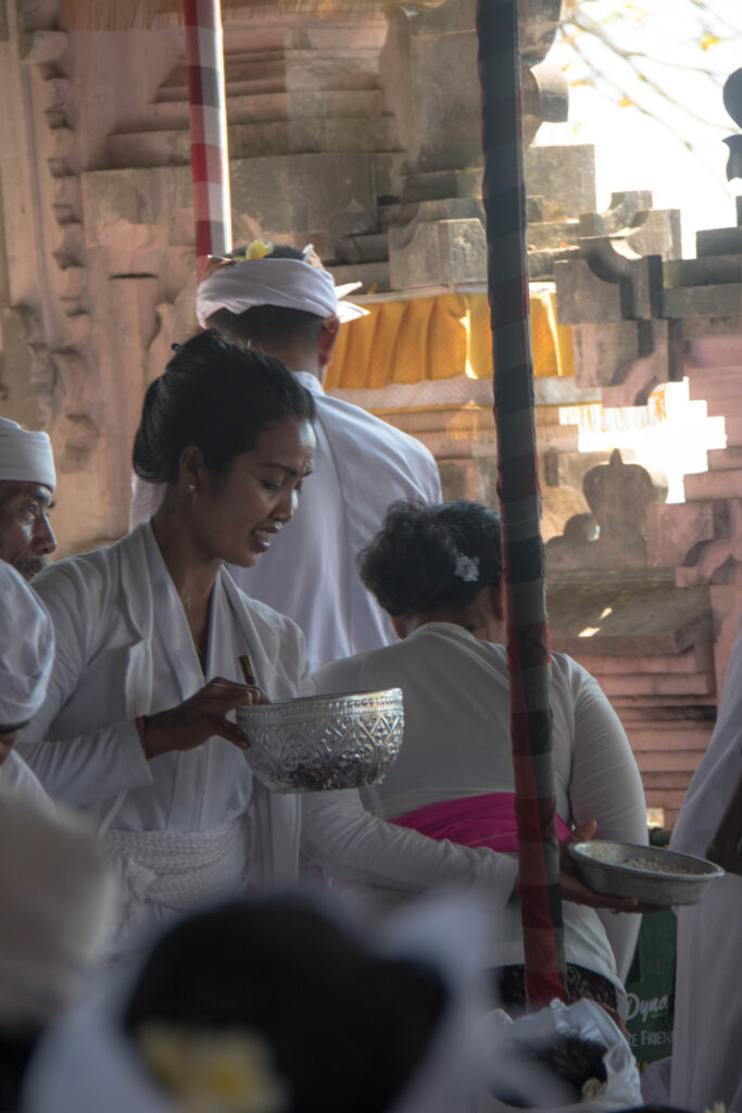
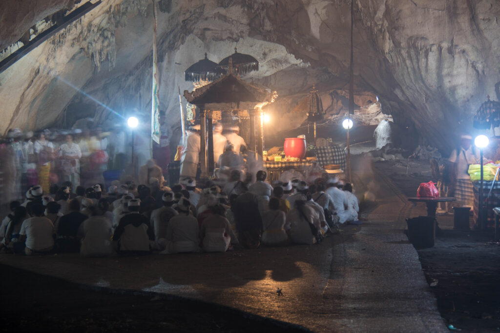
Worshippers in white and offerings during a ceremony at Goa Giri Putri temple
Hindu ceremony inside the cave of Goa Giri Putri temple

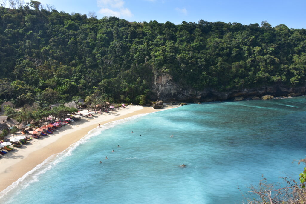
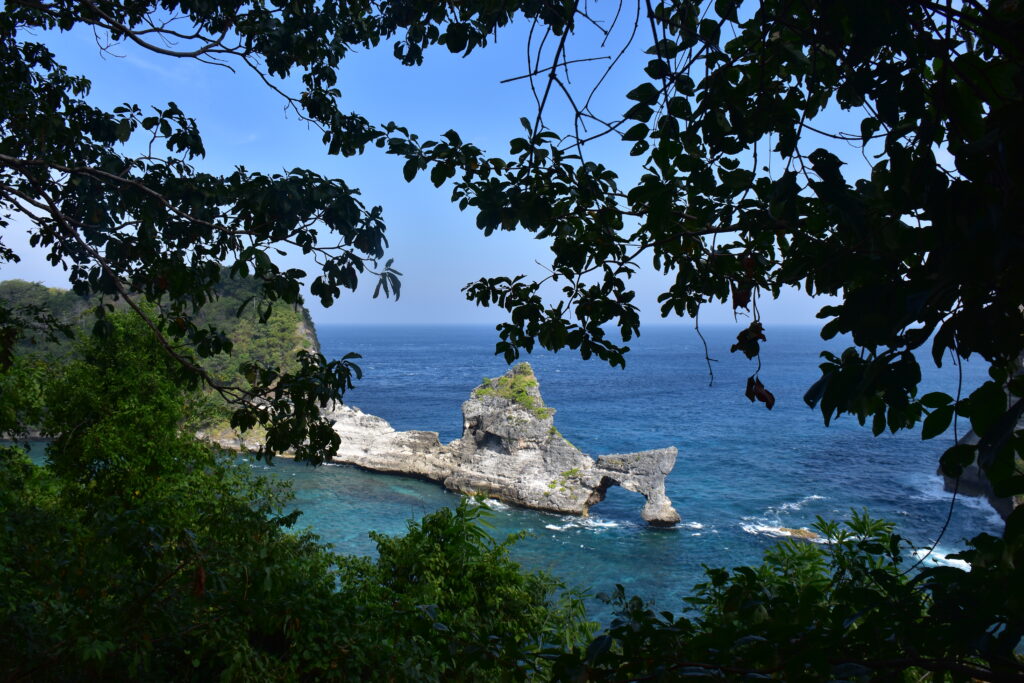
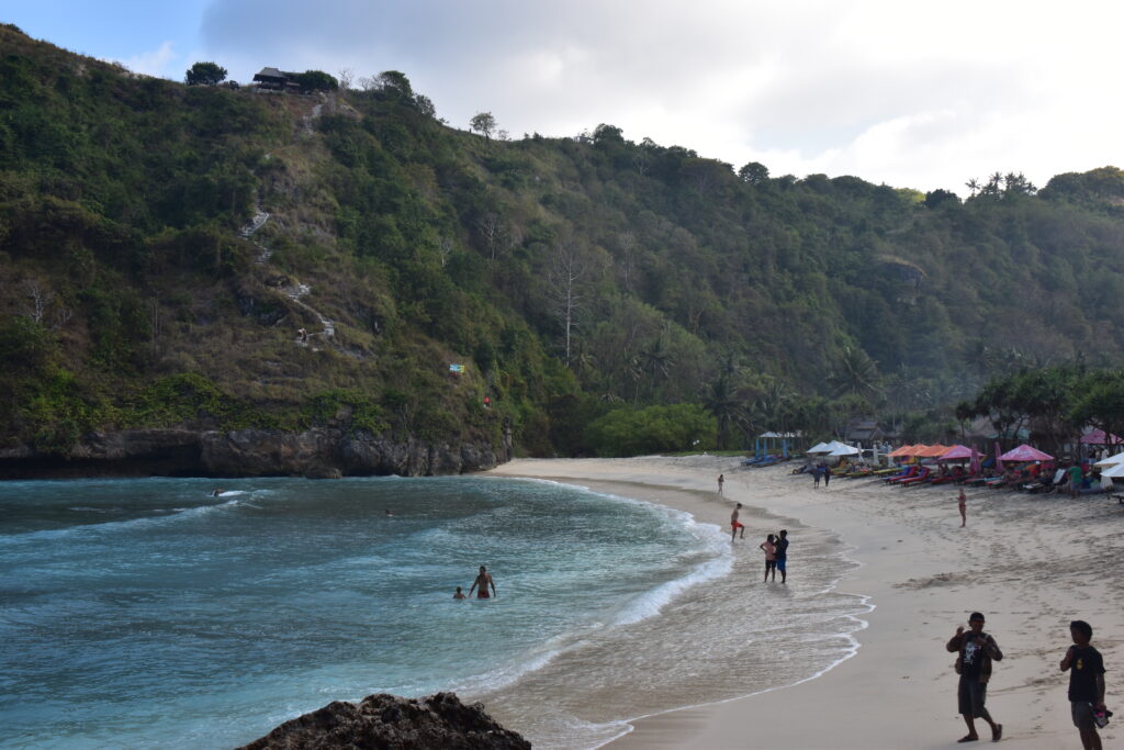
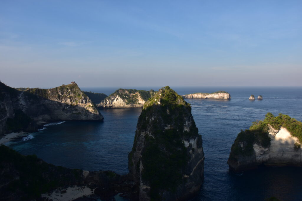
On the road to Atuh Beach, a stop at Warung Forest — a “warung” being, in Indonesia, a small family-run eatery, this one set right in the middle of the forest, with animals roaming free (chickens, cats) all around. The owner, generous with advice, even draws me a map of his favorite spots. Excellent food, total calm: a real find. Then off to Atuh Beach, after a failed detour to another beach (30 minutes of bumpy dirt track for nothing, U-turn). A superb view from the top over a small island with a hole through the rock, turquoise water below.
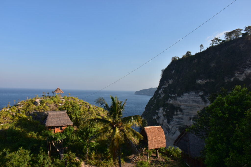
A quick detour to “Thousand Islands,” a complex with treehouse-style huts (Rp 10,000, nice but nothing more), before trying to get to Teletubbies Hill — glimpsed from the road, but I couldn’t find a way up in time before sunset. Another time. Back to the hostel through a handful of smiling villages, with a distant view of what looks like Mount Agung, on the island of Bali.
Sun setting over the forest on the way back, Nusa Penida
Day 8

A new hostel and the blue steps of Peguyangan

A change of hostel to “Bintang homestay & hostel,” farther west on the island — classy, though a bit overwhelmed when I arrive. While I wait, I act as an improvised interpreter for two travelers: a Frenchman who doesn’t speak English, and a Russian who swears only by Google Translate. Then off to Peguyangan Waterfall, with its famous flight of blue steps carved into the cliffside (Rp 5,000 for parking, Rp 10,000 for the mandatory sarong). At the bottom, a small waterfall pouring straight into the sea, a temple, and natural pools set into the rock — I don’t really enjoy them, too hungry and in a hurry to climb back up before my legs give out completely.
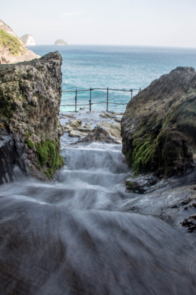
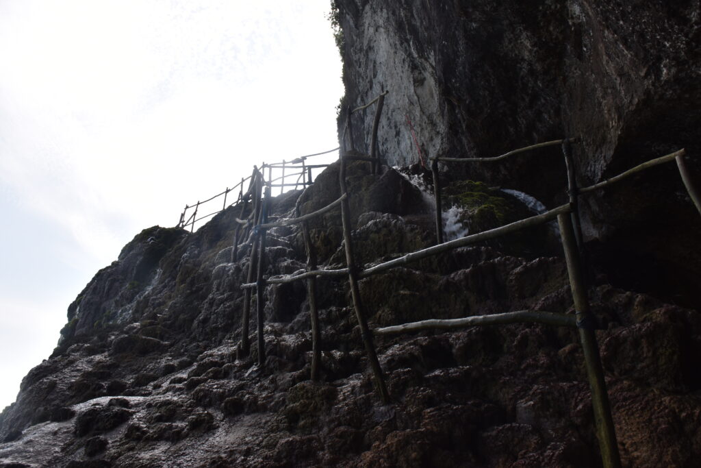
Peguyangan waterfall pouring toward the sea between the rocks
Staircase down the cliffside to Peguyangan waterfall

Next, off to Saren Cliff, a lesser-known viewpoint near Manta Point: the road, alternating excellent stretches and wrecked tracks, isn’t easy to find, but the reward — a little swing, a view of the cliffs, almost nobody there — is worth the detour. I leave before nightfall, not too keen on riding these roads once the sun has set.
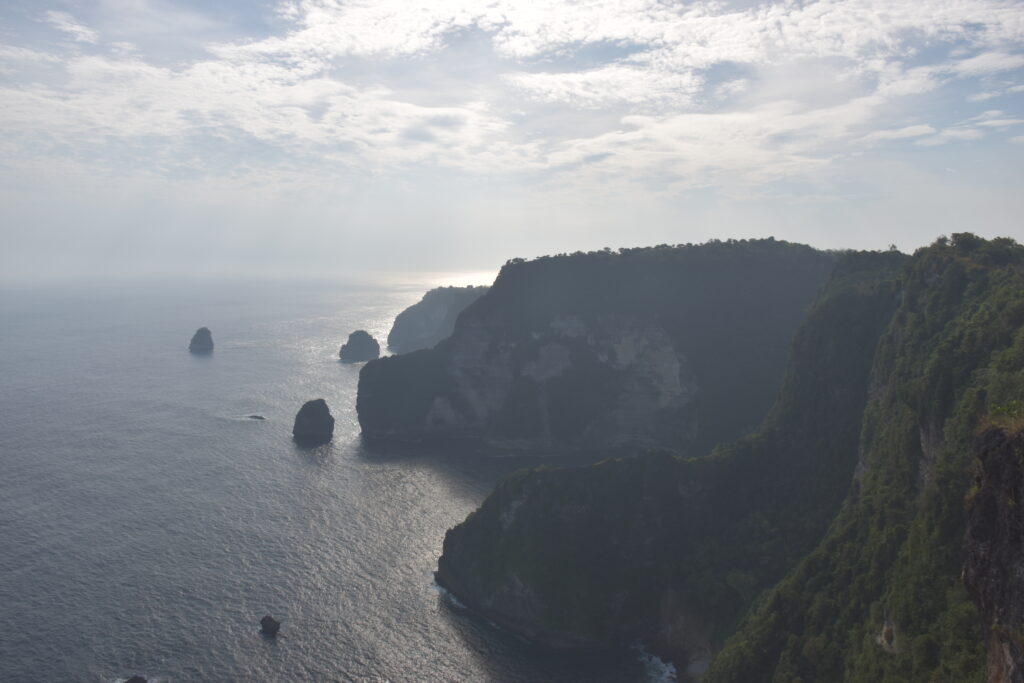
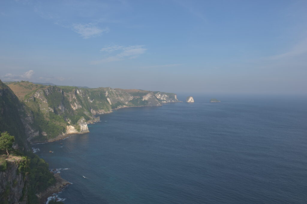
(Along the way, I spot a few manta rays from the road, cruising offshore — a nice foretaste of the next day.)
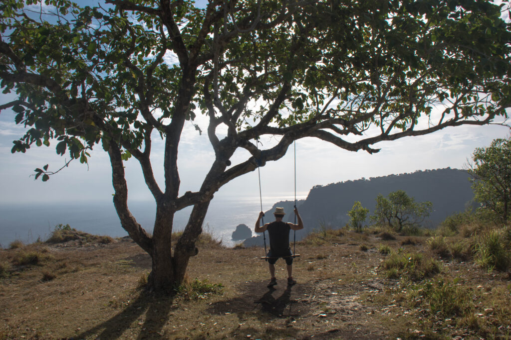
Damien on the swing hanging from a tree at Saren Cliff, facing the sea
Day 9

Swimming with manta rays

Determined to see the mantas up close, I head to Crystal Bay at 9 a.m. The solo rate turns out to be double the group rate — so I wait for other tourists to show up. Lucky break: an American couple I’d met the day before comes by, heading for Manta Bay and Gamat Bay, Rp 250,000 for the two spots; an Australian woman joins us. At Manta Bay, a ray appears almost immediately, then two at once a little later — I’m the last one back on the boat, and they pass right beneath me, almost brushing against me. Swimming a few meters from creatures with a wingspan of one to one and a half meters, back and forth again and again: one of the great moments of the trip. Then on to Gamat for more classic snorkeling — colorful coral, fewer people, a surprising mix of warm and cold currents.
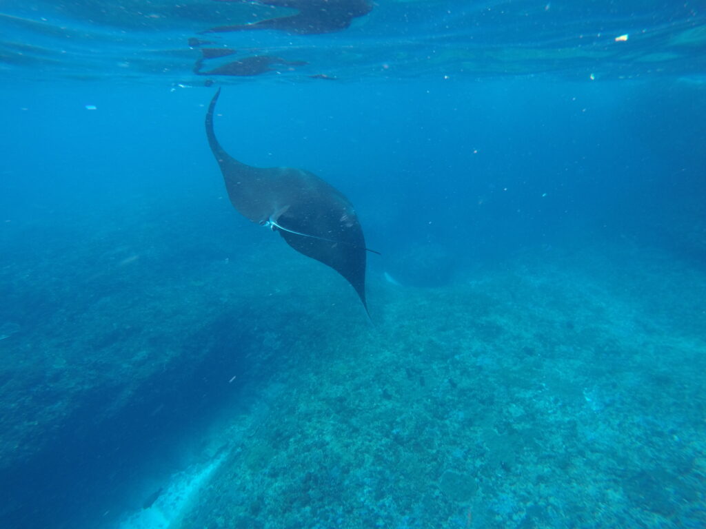
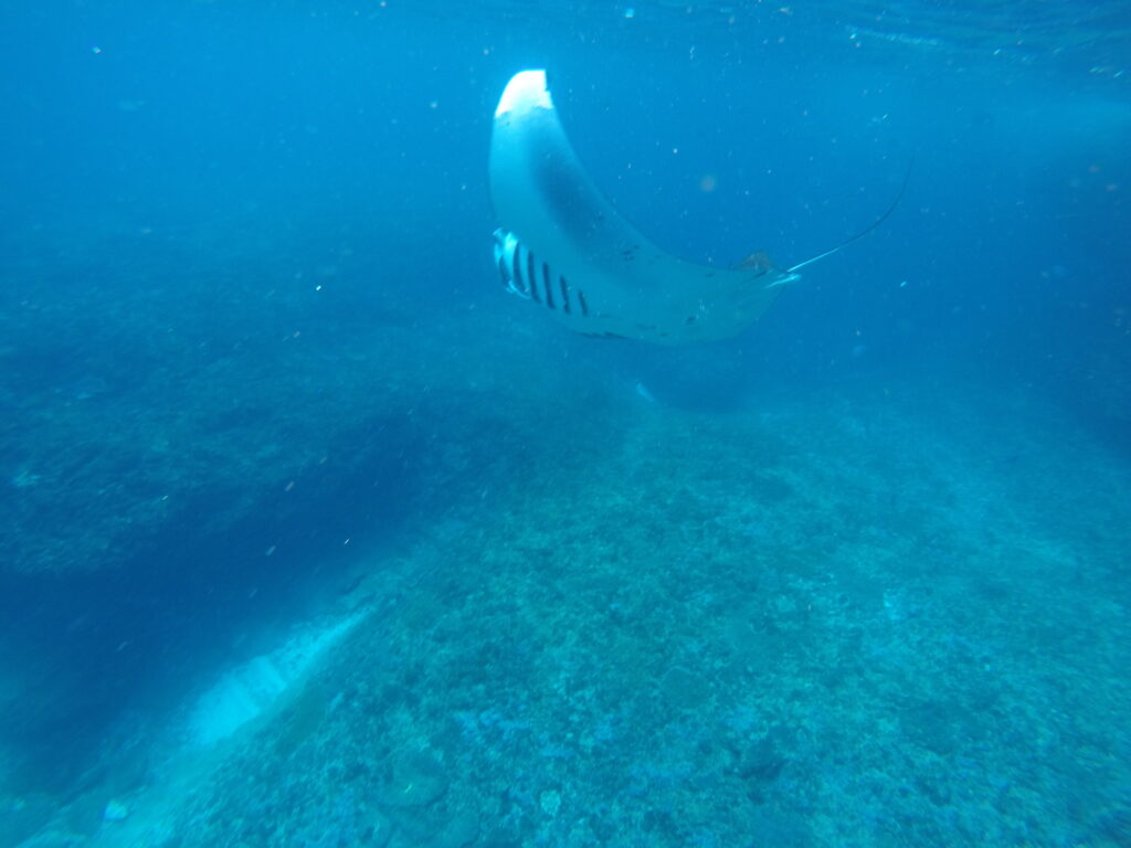
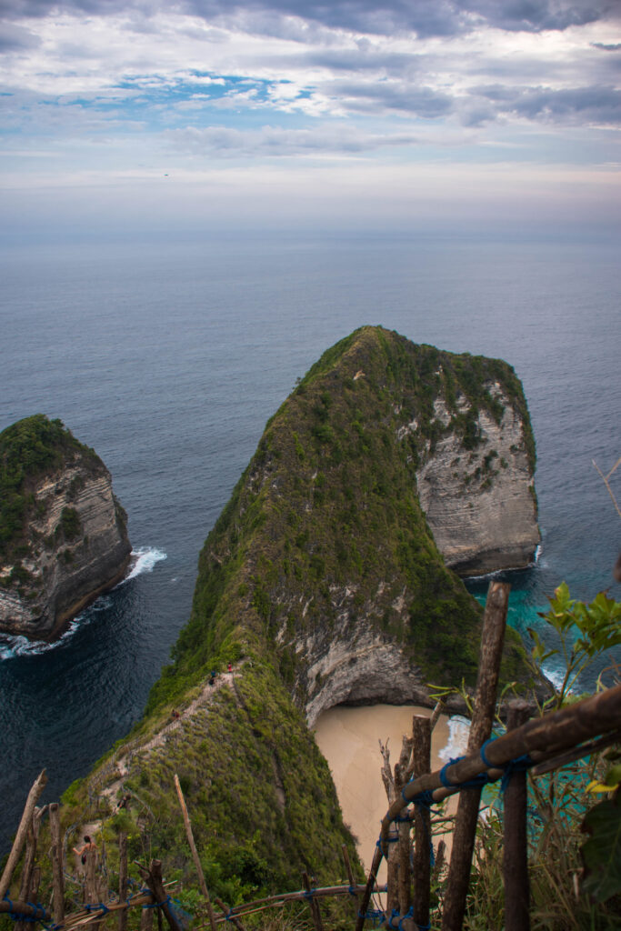
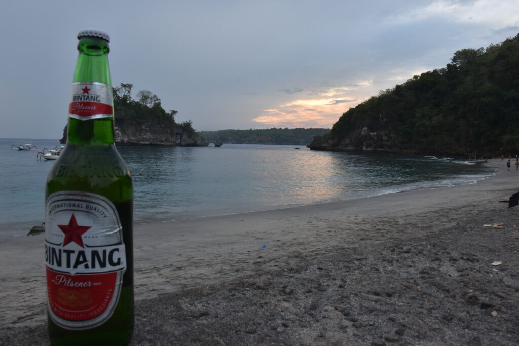
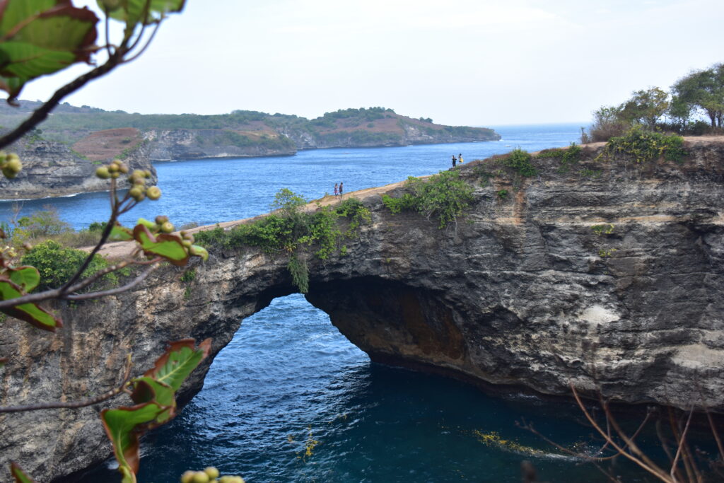
In the afternoon, off to Broken Beach (Rp 5,000 for parking): a spectacular natural pool, but a dangerous one because of the waves surging into it, then the famous circular cove with a natural bridge through the cliff — magnificent, but I don’t linger, since there’s no room at the hostel for an extra night and I need to keep moving. Then on to Kelingking Beach, the famous T-Rex-shaped cliff: the view from the top is more than enough, no need to go all the way down to the beach. A last attempt to reach Gamat Bay for a sunset beer — bad idea, the path turns out to be a real ordeal of sand and big rocks, and two French guys I meet on the way talk me out of pushing on (they had wisely left their scooter higher up). I push mine over the last few meters, reaching the top a bit out of breath but smiling: final destination Crystal Bay, for a well-earned beer and a sunset that rounds off the day perfectly.
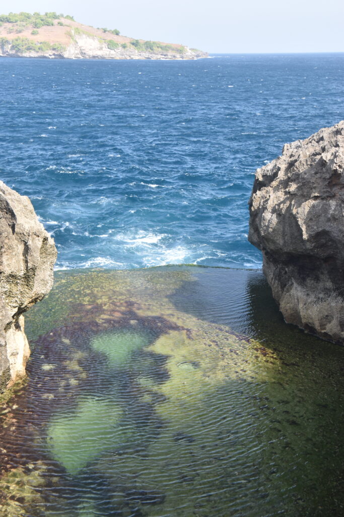
Natural pool between the rocks facing the ocean at Broken Beach
Broken Beach
Natural arch through the cliff at Broken Beach
Broken Beach
T-Rex-shaped cliff overlooking Kelingking Beach
Kelingking Beach
Bottle of Bintang on the beach at sunset, Crystal Bay
Crystal Bay
Day 10

A rushed return

Back to Padang Bai by ferry. An Indonesian man strikes up a conversation, I show him a few videos on my phone, he’s a fan and captures the moment with a selfie posted straight to Facebook. Back on land, the hostel is full, and I manage to find a small room elsewhere. Then a call from my landlord, thousands of kilometers away: a problem that needs sorting out urgently. The trip comes to an abrupt end — decision made to bring my return forward to the next day.
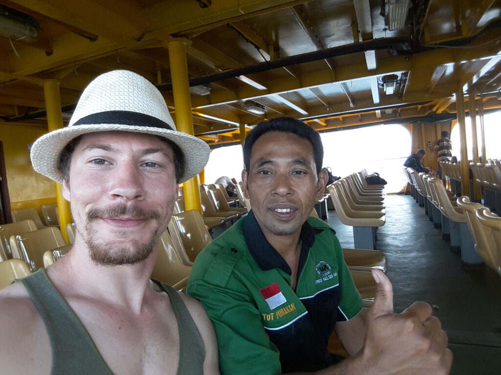
Selfie of Damien in a hat with an Indonesian passenger on board the ferry

Looking Back

Ten days that didn’t go to plan right to the end, but that will stay marked by a few strong images: a monkey’s attempted theft of a water bottle, a funeral procession met by chance on a mountain road, and above all those few suspended minutes swimming alongside manta rays at Nusa Penida. And then that funny constant all along — running into the same faces day after day (Christelle and Jules, met at the airport and then found again by chance on an island) even though nothing was planned for that to happen. Bali remains a treasure trove of natural wonders too often captured by mass tourism and its “mandatory donation” logic — but sometimes all it takes is to push a little farther, as at Saren Cliff or that godsend of a warung on Saturday, to find a bit of calm again.
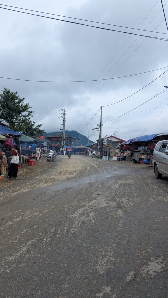
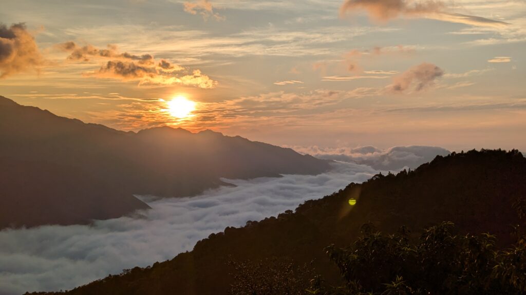
5:30 am, and the valley has vanished. In its place, a river of clouds flows between the mountains, and the sun rises just above the ridges. This is the moment people come to Ta Xua for, a village perched in the mountains of northwest Vietnam. We spent three nights there as a couple in August 2025, right in the rainy season, so outside the official cloud season, and we still got our sea of clouds. Here’s what you really see at that time of year, how to walk the Dinosaur Spine (on foot, not by scooter), which mountain roads to ride on two wheels, and how to get there from Hanoi without getting stuck in Bac Yen.


Where is Ta Xua, and is it worth visiting?

Ta Xua (Tà Xùa in Vietnamese) is a mountain village in Son La province, in northwest Vietnam. People come for three things: the clouds that fill the valleys at dawn, grassy ridges like the Dinosaur Spine, and the small mountain roads, where every bend opens up a new view.

You won’t see many Westerners here. During our stay, we may well have been the only Western tourists. It was still busy, though, mostly with young Vietnamese people up from the city as couples or groups of friends, often dressed up and there largely for the photos.

The village is changing fast: in August 2025, there was construction work going on almost everywhere. Ta Xua is likely to become much more touristy in the years to come.

Who is it for? If you love nature, photography and mountain roads on a scooter, and you’re ready to get up before 5:30 am to see the clouds, Ta Xua is well worth the trip.

Who might struggle? If you’re looking for guided tours in English, lots of services or an international backpacker vibe, you’ll feel less at ease: English is rare, and communicating takes a bit of patience.


The sea of clouds: when to see it, and what you see in August

Cloud season

According to local sources, the best time to see the sea of clouds in Ta Xua runs from October-November to April, peaking from December to March. Summer is the rainy season: the sources advise against it, mainly because the tracks get slippery and landslides can happen.

What we saw in August 2025

On 20 August, around 5:30 am, from the terrace of our guesthouse: a real sea of clouds, filling the valley under an orange sunrise. Probably lower and less spectacular than in peak season, but the show was definitely there.

The same day around 8 am, from a small café-bar north of the village, facing east: it wasn’t quite a sea of clouds anymore, but there were still beautiful banks of cloud in the valley, with the sun on the hills.

The other mornings, a little later: just a few clouds, not really a sea.

Our verdict: in August, the sea of clouds is possible, not guaranteed. One good morning out of three for us. The weather on the day decides, and nobody can promise it to you.

How to give yourself the best chance

  • Stay somewhere with a valley view: we saw the sea of clouds from our terrace, without having to ride a scooter in the dark.
  • Stay several nights: with just one night, we might have missed it.
  • Get up early: the show happens at sunrise, around 5:30 am in August.
  • If the clouds clear, don’t leave right away: a café facing east, early in the morning, still gives you a great view of the clouds lingering in the valleys.

The Dinosaur Spine: access, time and difficulty

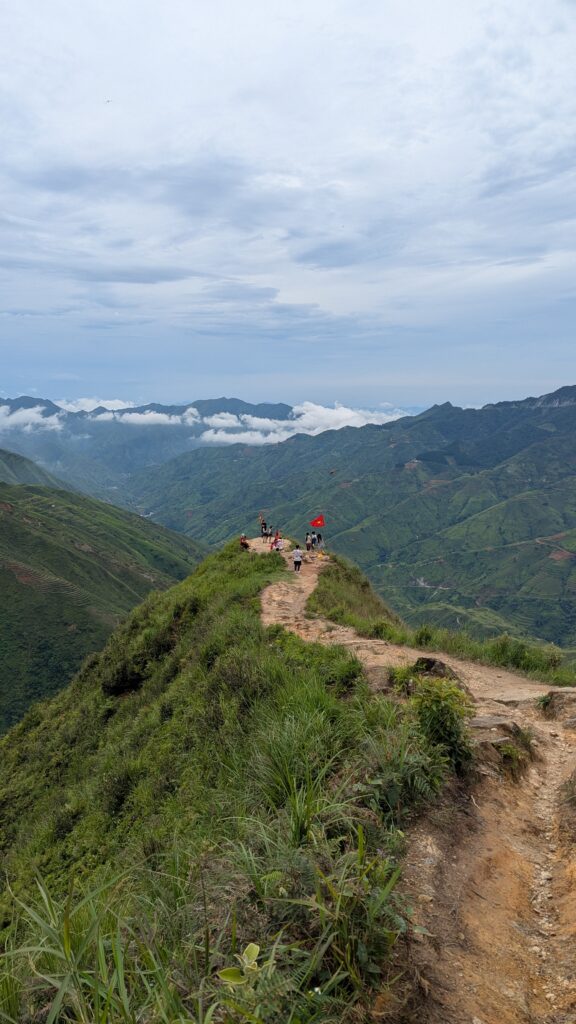
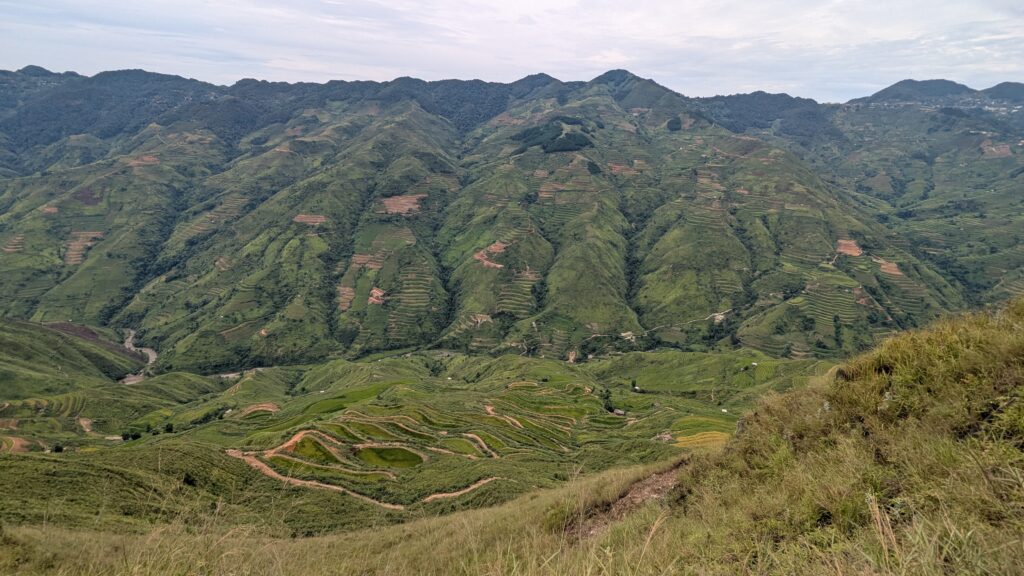
The Dinosaur Spine (Sống Lưng Khủng Long, also called the Dinosaur Ridge) is Ta Xua’s signature hike: a narrow grassy ridge with steep slopes on both sides, looking out over the mountains and terraced rice fields. According to the sources, the ridge is about 0.6 miles (1 km) long and sits between about 4,900 and 5,900 feet (1,500 to 1,800 m) above sea level.

Getting to the trailhead

We rode there by scooter from the village. You park in a paid parking area just before the start of the trail: about 10,000 VND (less than half a dollar) for a scooter in August 2025, if I remember right. From there, you have two options: carry on on foot, or get a ride down on a motorbike with a local rider (see below). We did the whole thing on foot, and it’s absolutely doable.

How long does it take?

Allow about 1 hour to walk down to the end of the ridge, and 1 hour or a bit more to climb back up. The way back up is the most tiring part: save some energy (and some water) for it.

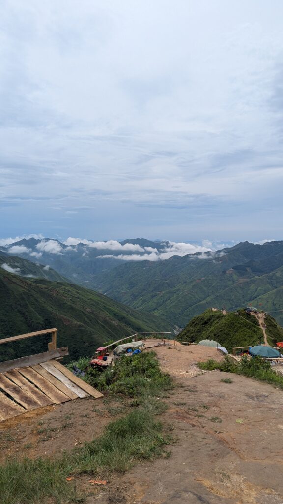
Along the way, one of the first viewpoints is a small open area with stalls, tents and parasols: a good spot for a break before you tackle the ridge.

Should you ride the Dinosaur Spine on a motorbike?

No, and I strongly advise against it. Some people take their scooters onto the trail, and some tour companies sell the Dinosaur Spine as a motorbike ride. But the path is genuinely dangerous on two wheels: slippery, and full of holes dug by the rain when we were there. On foot, it’s a pleasant walk and you get to enjoy the view. On a scooter, it’s a gamble.

If you don’t want to walk, local young people ride up and down the spine on motorbikes, taking visitors (mostly Vietnamese) down and back up. We sometimes saw them carrying two or three passengers on the same seat. It’s doable, and they know the path, but I don’t recommend it: it’s still dangerous. I don’t know the price, as we didn’t ask. And if you’re not an experienced off-road rider, don’t try this track on your rental scooter.

At the end of the ridge, look for the little side path

The end of the ridge was busy. We took a small path off to the side, which leads to a quieter spot where we were on our own. Two young girls in traditional dress joined us there, without trying to sell us anything: they tried to chat with us, then gave us some little flowers. A lovely memory, and proof that not every encounter is about money.

On the trail itself, though, you’ll pass locals in traditional dress selling flowers, mostly to Vietnamese visitors who use them in their photos.

Before you go: bring water, sun protection and shoes with good grip, as the trail can be slippery after rain.


Mountain roads by motorbike: the viewpoints around Ta Xua

The other joy of Ta Xua is riding the small mountain roads and stopping whenever the view opens up. Here’s what we did in two days on a scooter.

A word of warning first: neither Google Maps nor Maps.me is reliable here. Many viewpoints have no name on the maps, or several names, and some roads have no name at all. The names below are the ones we found, so take them with a pinch of salt.

Dolphin Cliff (Mỏm Cá Heo)

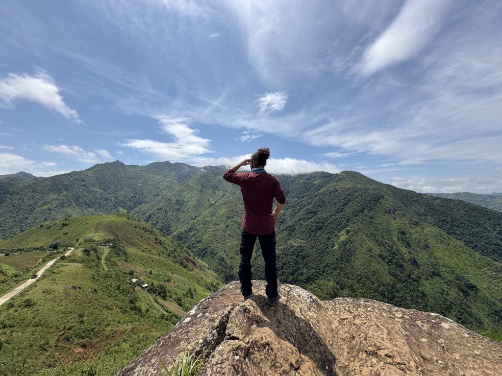
A big rock jutting out over the valley, with a wide-open view of the mountains.

The Lonely Tree (Cây cô đơn)

We rode past without stopping. To get close to the tree, there was an entrance fee, if I remember right. Honestly, it didn’t seem that interesting to us: it’s mostly a photo spot. But if you want the iconic Ta Xua photo, that’s where to go: bring a little cash for the entrance.

Camel’s Back

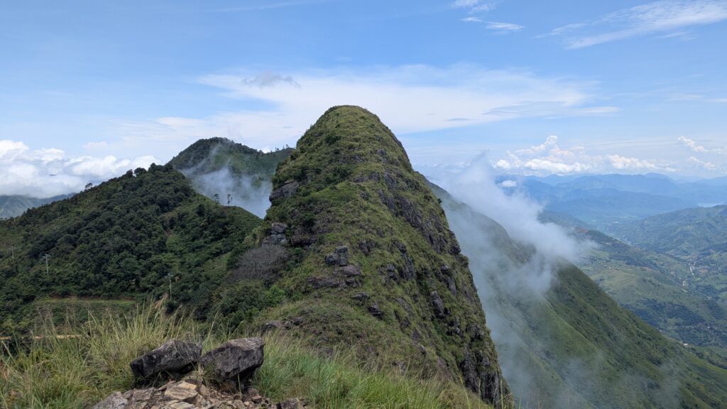
We stopped at a viewpoint that we believe is the Camel’s Back: a small grassy, rocky hill, with clouds creeping up its sides that day.

There’s no sign. We parked in what looked like a parking area, then looked for the path up to the top of the hill. The climb is neither long nor hard, but it isn’t a flat path, and it can be slippery: wear shoes with good grip.

Grassy hill of the Camel's Back with clouds, near Ta Xua, Vietnam

The road east, down to the river

A road heads east from Ta Xua, with viewpoints we found more or less by chance, stopping as we went round the bends. We followed it to the bank of a river (the Suoi Be on Maps.me, nowhere to be found on Google Maps), then turned back, passing the Háng Đồng A1 hydroelectric plant on the way up.

No famous spot here: just the mountains and the road. If you like routes few visitors take, it’s a beautiful ride.


How to get from Hanoi to Ta Xua (and the Bac Yen trap)

The first thing to know: you’ll almost certainly go through Bac Yen. Big buses don’t go up the small mountain roads to Ta Xua. So the trip is done in two legs, with a change in Bac Yen.

The trap isn’t Bac Yen itself, it’s arriving there with no connection lined up. We tried both: no booking at all on the way there, a trip booked end to end on the way back.

On the way there: what we did

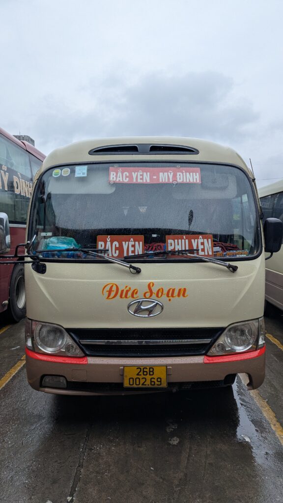
We hadn’t booked anything. We simply went to My Dinh bus station (Bến xe Mỹ Đình), in the west of Hanoi, where we took a local minibus signed “My Dinh – Bac Yen”, thinking we’d find a local bus to Ta Xua from there.

  • Minibus Hanoi → Bac Yen: 400,000 VND for two (about US$15) in August 2025.
  • Then, in Bac Yen, nothing left for Ta Xua. There may be a local bus, but if so, we arrived too late. A taxi was the only option: 400,000 VND (about US$15).
Local minibus from My Dinh bus station to Bac Yen
The local minibus from My Dinh to Bac Yen

My advice: book a complete Hanoi → Ta Xua trip

Looking back, the easiest way is to book an end-to-end trip in advance. Don’t be surprised if there’s still a change in Bac Yen: there was for our return trip (see below). The difference is that the connection is organized and included in the price, with no unexpected taxi.

You have two options for booking:

  • Online, before you leave: Hanoi → Ta Xua and Ta Xua → Hanoi trips show up on booking platforms, with times and prices. We haven’t tried it, but it’s probably the easiest way: no language barrier, and you know what to expect.
  • At a local agency, once you’re there: that’s what we did for the return trip (see below). It works, but be ready for a bit of patience.

If you’d rather do what we did on the way there, by local bus, leave Hanoi early and budget for the taxi from Bac Yen.

On the way back: a booked trip, minibus then sleeper bus

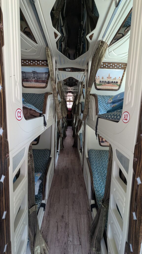
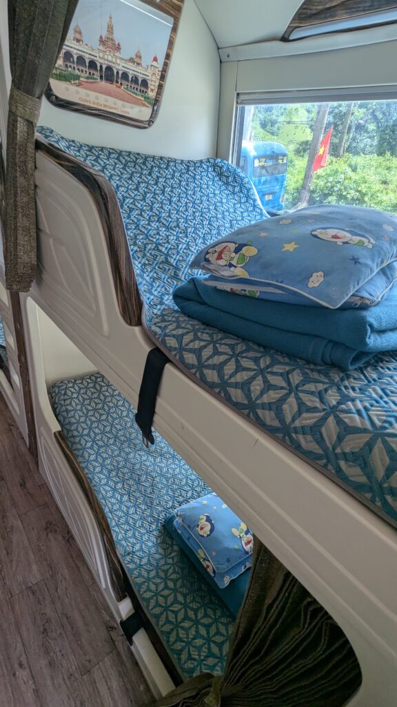
This time, we booked our Ta Xua → Hanoi trip at a local agency in the village. Making ourselves understood wasn’t easy: nobody spoke English, and we were first offered a taxi at a crazy price. In the end, we got the complete trip. In practice, it was a minibus to Bac Yen, then a change to a sleeper bus to Hanoi, all on the same ticket. We traveled by day, with a pillow and blanket provided on the sleeper bus. Price: about 450,000 VND per person (about US$17) in August 2025, if I remember right.

For two people, it’s a bit more expensive than our way there (minibus then taxi, about 800,000 VND for two), but with no bad surprises: you know from the start what you’re paying and how you’ll get there.


Renting a scooter in Ta Xua: license and insurance

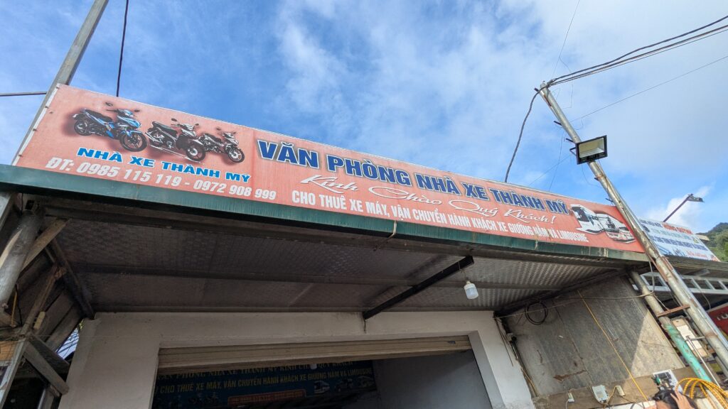
We rented our scooter from Nhà xe Thành Mỹ, in the village: 300,000 VND for two days (about US$11) in August 2025.

Front of the Nhà xe Thành Mỹ shop, where to rent a scooter in Ta Xua

Nobody asked to see a license. But not being checked by the rental shop doesn’t mean you’re legal: to ride a scooter in Vietnam, you need a license valid for motorbikes and an International Driving Permit recognized by Vietnam. Without a valid license, your travel insurance may not cover you if you have an accident. Before you go, check your license and read your insurance policy.


Where to stay in Ta Xua

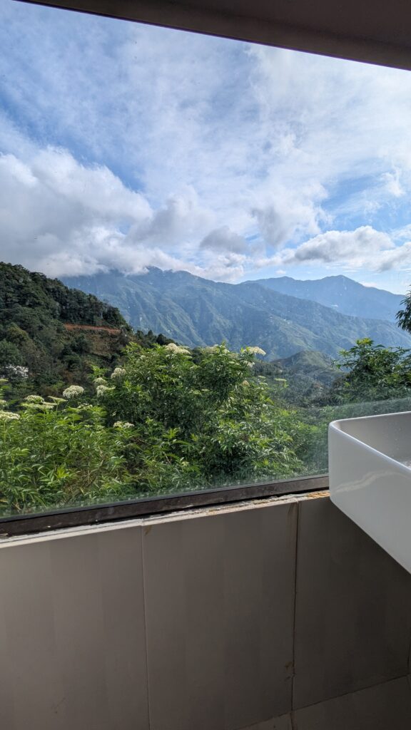
We stayed at Cloud Garden, about €22 (about US$25) a night in August 2025. It was nice, with one real highlight: the terrace, looking out over the valley. That’s where we saw the sea of clouds on 20 August, without leaving our guesthouse. Even the bathroom has a mountain view. The downside: an extremely hard mattress.

Our tip for choosing where to stay: before you look at the price, look at the view. In Ta Xua, a terrace facing the valley means you can enjoy the clouds when you wake up, without riding in the dark.


Where to eat and drink in Ta Xua

No need to look far: in August 2025, you could find food all over the village, for every budget. We don’t have a specific address to give you, and that’s on purpose: we rarely pick a restaurant in advance. We look at the menu, the prices, the food and the setting, and we go wherever is open. In Ta Xua, that works really well.

Menus are very rarely in English: a translation app (with the camera mode for reading menus) is your best friend.

The main street, the heart of the village

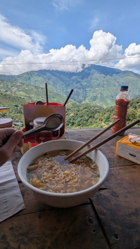
Almost at the entrance to the village, the main street acts as the village square, around a viewpoint that Google Maps calls Thiên Đường Mây Tà Xùa (“cloud paradise”). You’ll find restaurants, cafés and street food stalls there. The restaurants, some pricier than others, often have a view of the valley, and there’s plenty of noodle soup on the menus.

Bowl of noodle soup on a terrace, with mountains and clouds behind, Ta Xua

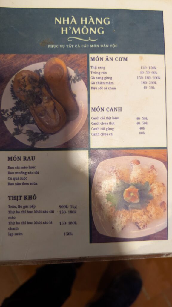
To give you an idea of prices, here’s the menu from one of the restaurants in the center, entirely in Vietnamese like almost everywhere. In August 2025, it listed:

  • soups (canh) from 40,000 to 80,000 VND (about US$1.50 to US$3);
  • dishes to eat with rice, such as chicken stir-fried with ginger (gà rang gừng), from 40,000 to 200,000 VND depending on the dish and the size (about US$1.50 to US$7.50);
  • smoked meats, a specialty of the northwest mountains: stir-fried smoked pork belly (thịt ba chỉ hun khói) from 150,000 to 180,000 VND, or buffalo or beef dried above the kitchen fire (trâu, bò gác bếp) at 900,000 VND a kilo (about US$35).

Menu-reading tip: on menus, “50k” means 50,000 VND. When two or three prices follow each other (“150-180-200k”), they usually match different portion sizes.

If you’re vegetarian: finding vegetarian dishes isn’t always easy in Ta Xua. Traveling with a vegetarian, we had to skip the lẩu (hot pot). On the menu above, you’ll still find tofu in tomato sauce (đậu sốt cà chua), fried eggs (trứng rán) and stir-fried vegetables (món rau). Point to them on the menu, or use your translation app to ask for a dish without meat.

Street food on the main street

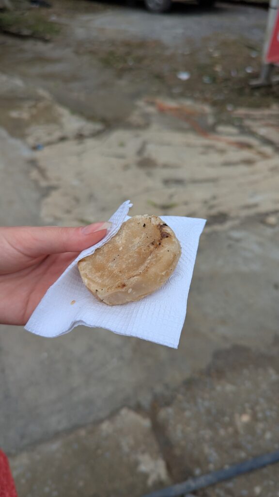
For something cheaper and quicker, there’s street food on the main street: bánh mì (the Vietnamese sandwich) and other dishes cooked right on the street, on small grills.

Further north: the street of cafés and restaurants with a view

Carrying on north, a few minutes from the center by scooter, the road is lined with restaurants and café-bars, with a view on one side or the other depending on which side of the road you’re on. In August 2025:

  • on the right, mostly restaurants;
  • on the left, mostly café-bars, a little cheaper and more rustic, with a view to the east.

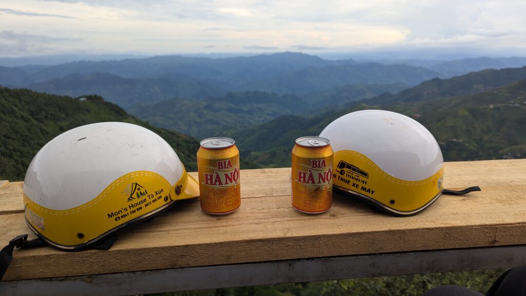
It’s lovely in the morning for a coffee facing the clouds, and at the end of the day for a beer facing the mountains. We didn’t note the names, and everything changes fast here: just go with your gut, and pick the side with the view you want.

Two scooter helmets and two cans of beer facing the Ta Xua mountains

What to know before you go

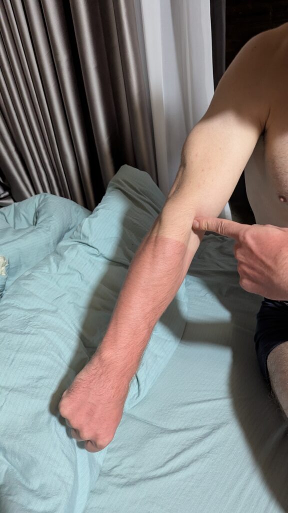
  • The sun is strong, even when it isn’t hot. At altitude, the temperature stays pleasant and you let your guard down. I learned the hard way: sunburned forearms. Sunscreen, long sleeves, or both.
  • Little English. Even less than elsewhere in Vietnam. Bring a translation app, with Vietnamese downloaded for offline use.
  • Bring water, especially for the Dinosaur Spine and days on the scooter.
  • Maps are approximate: keep some battery and data to find your way.
  • Sellers: a few children in traditional dress will offer you flowers or other small things, in the village and on the Dinosaur Spine trail.
  • In the rainy season (roughly summer to early fall), tracks can be slippery and landslides are possible: check road conditions before you set off.
Arm marked by sunburn after a day on a scooter in Ta Xua

In short

Ta Xua means waking up above the clouds, a ridge to walk on foot and mountain roads where you stop at every bend. In August, the sea of clouds isn’t guaranteed, but it’s possible: stay somewhere with a view, stay at least three nights, and get up early. And to get there from Hanoi, book a trip that goes all the way to the village, or budget for the taxi from Bac Yen.

The village is changing fast: go before it becomes just another stop on the tourist trail.