In four days from Las Vegas, you go from the Nevada desert to the rim of the Grand Canyon, then from the pine forests around Flagstaff to the red rocks of Sedona, before heading back on one of the longest surviving stretches of Route 66. I lived in Las Vegas for two years, and this is the loop I drove from 5 to 8 May 2025, solo: about 905 miles (1,460 km), two big hikes, three budget nights in Williams and Flagstaff instead of the park’s hotels, and an improvised drive home via Seligman and the Hoover Dam. Here’s the day-by-day itinerary, with my real timings, the driving times, where to stay and what it cost me.
At a glance
HOW LONG
4 days and 3 nights, by car; ideally 6 to 7 days to slow down
DISTANCE
About 905 miles (1,460 km) and 16 hours of driving for the whole loop
WHEN TO GO
Spring and fall; I went in early May
WHERE TO STAY
Williams (1 night) then Flagstaff (2 nights), much cheaper than the park or Sedona
PASS
The America the Beautiful pass covers the Grand Canyon and most trailhead parking in Sedona
WALKING
About 27 miles (43 km) over 4 days, easy to shorten
THE STOPS
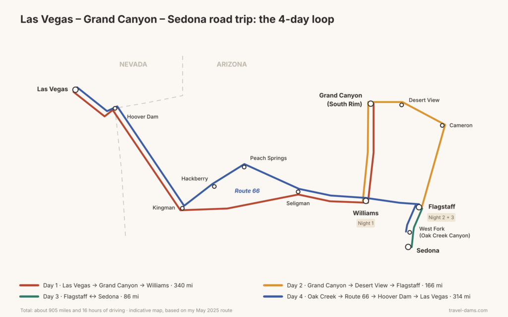
Las Vegas → Grand Canyon (South Rim) → Williams → Grand Canyon → Flagstaff → Sedona → Oak Creek Canyon → Route 66 → Hoover Dam → Las Vegas
How many days do you need for the Grand Canyon and Sedona?
Four days is doable, and that’s what I did. The drive between Las Vegas and the Grand Canyon takes half a day each way, which still leaves time to enjoy it: on the first day, I reached the park in the early afternoon and still had time for Hermit Road; on the last day, I hiked West Fork, in Oak Creek Canyon, before hitting the road. In between, one day at the Grand Canyon and one in Sedona. The stops follow on nicely: every night, you sleep on the way to the next day’s sights.
With more time, I’d add one day at the Grand Canyon and one or two days in Sedona, to hike other trails, see a bit of the town, and find out more about the vortexes and crystal shops that draw so many people there. Over 6 to 7 days, that means two nights near the Grand Canyon and three in Flagstaff or Sedona. But if you only have four days, honestly, I wouldn’t change a thing: the desert road on the way in, the Grand Canyon, a good hike, a relaxed afternoon of viewpoints by car, then Oak Creek and Sedona. The scenery changes enormously from one day to the next.
Who is it for, and at what pace?
As a couple, a family or solo, this road trip isn’t too tiring: you see very different landscapes in a short time, with no punishing driving day in the middle. The most demanding part is the walking. Here’s what I did, with official distances where they exist:
| Day | Walking | Distance (approx.) |
|---|---|---|
| 1 | Hermit Road, mixing the Rim Trail and the shuttle | 6 mi (10 km) |
| 2 | South Kaibab Trail to Skeleton Point (2,040 ft / 620 m of elevation change) | 6 mi (9.6 km) |
| 3 | Cathedral Rock, Fay Canyon and its arch, Devil’s Bridge | 8 mi (13 km) |
| 4 | West Fork, in Oak Creek Canyon | 6.5 mi (10.4 km) |
| Total | 27 mi (43 km) |
Around 6 miles a day is comfortable if you walk regularly, more demanding if you don’t. The good news: everything is easy to shorten. At the Grand Canyon, you can turn around at Ooh Aah Point or Cedar Ridge; in Sedona, pick two trails out of three; on Hermit Road, stay on the shuttle a bit longer.
On the other hand, if you’re mainly coming to hike in the Grand Canyon, for example to do the Bright Angel Trail as well as South Kaibab, four days isn’t enough: you’d have to skip Hermit Road, or better, add a day.
Grand Canyon and Sedona on the same trip: is it worth the drive?
Yes, and that’s what makes this loop so good. The two are nothing alike: at the Grand Canyon, you look down into a huge chasm from the rim, then hike into it; in Sedona, you walk among red sandstone spires and arches, at eye level with the rocks. In between, Flagstaff and Oak Creek Canyon come as a surprise: pine forests and peaks that can still have snow in May, far from the “Arizona = desert” cliché.
As for driving, the Grand Canyon (South Rim) and Sedona are about 2 hours apart. Flagstaff, in between, is the natural base for both.
The itinerary at a glance
| Day | Route | Distance | Driving | Night |
|---|---|---|---|---|
| 1 | Las Vegas → Grand Canyon (South Rim) → Williams | 340 mi (547 km) | 5h25 | Williams |
| 2 | Williams → Grand Canyon → Desert View → Cameron → Flagstaff | 166 mi (267 km) | 3h10 | Flagstaff |
| 3 | Flagstaff → Sedona (Cathedral Rock, chapel, Fay Canyon, Devil’s Bridge) → Flagstaff | 86 mi (138 km) | 2h15 | Flagstaff |
| 4 | Flagstaff → West Fork → Oak Creek Vista → Seligman → Route 66 → Kingman → Hoover Dam → Las Vegas | 314 mi (505 km) | 5h20 | — |
| Total | about 905 mi (1,460 km) | about 16h15 |
These are driving times without stops, based on my route. In real life, allow more: on the first day, I left around 9–10 am and parked at the Grand Canyon around 2:15 pm, without stopping on the way. Shuttle rides inside the park aren’t included.
Day 1: Las Vegas to the Grand Canyon, then Williams
The drive: from Las Vegas, take US-93 southeast, then I-40 east at Kingman, and AZ-64 north at Williams up to the park’s South Entrance. About 280 miles (450 km) and just over 4 hours without stopping. Soon after Las Vegas, you cross the big bridge by the Hoover Dam, but you can’t see the dam from the road: save it for the way back. I didn’t stop at all on the way there: long straight roads, little traffic, and scenery unlike anything I knew from France, which was enough to keep me busy.
At the South Entrance, a few minutes’ wait at the booth, nothing major. I parked at the Visitor Center around 2:15 pm.
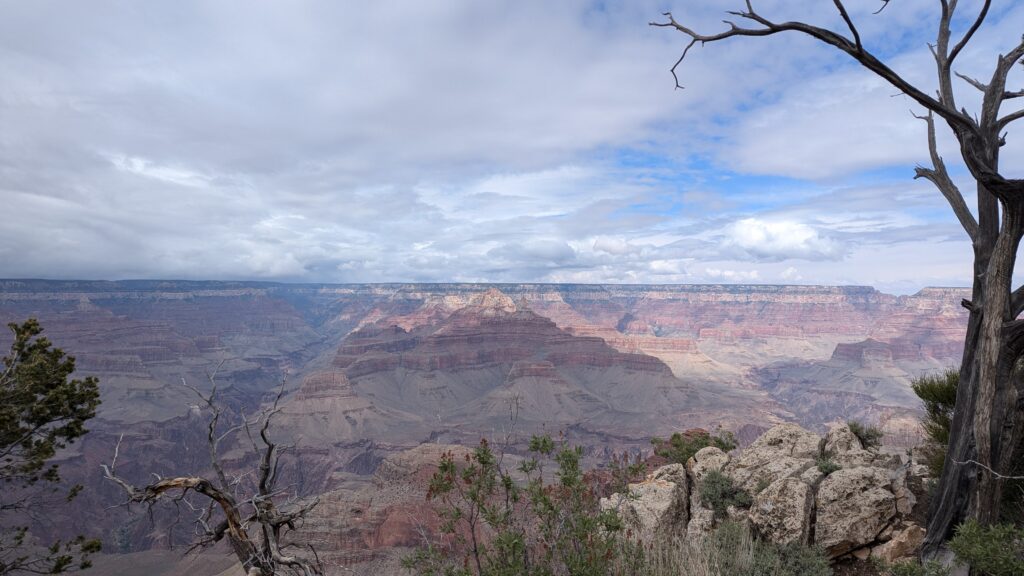
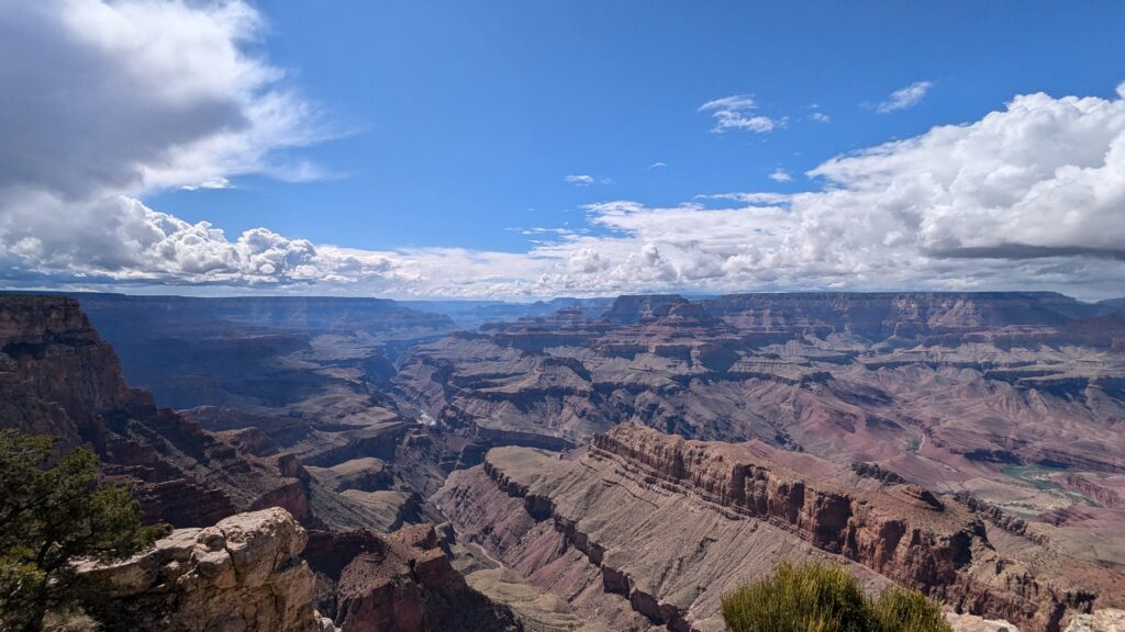
The afternoon: my first face-to-face with the canyon was at Mather Point, a stone’s throw from the Visitor Center parking. You walk a few yards, and suddenly the ground just stops: the Grand Canyon opens up in front of you, huge, as far as the eye can see. For a first time, the view is incredible.
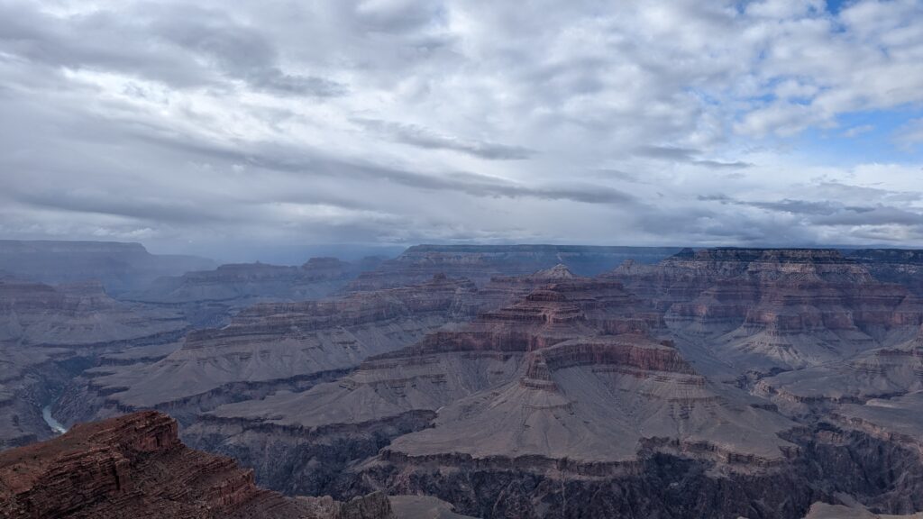
Then, on to Hermit Road, heading west. It’s closed to private cars for much of the year: you ride the free shuttle (Red Route) or walk the Rim Trail. I mixed the two, walking one stretch and taking the shuttle to the next, all the way to Hermits Rest. The further you go, the fewer people there are. I took the shuttle back around 6 pm and left the park around 7:30–8 pm.
All the details on Hermit Road, the shuttles and the viewpoints are in my South Kaibab Trail guide.
South Kaibab Trail to Skeleton Point: A Grand Canyon South Rim Day Hike (and the Viewpoints to Add)
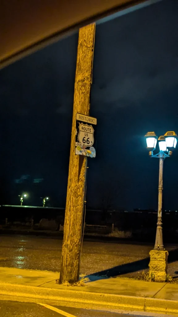
The evening in Williams: I got there around 8:50 pm and only found out then that Route 66 runs through town. I had no idea. A few restaurants and bars were open along the main street; it was late, so McDonald’s it was. Williams is also where the Grand Canyon Railway starts, a tourist train that runs up to the South Rim. I only drove past it, after 9 pm (see below).
Day 2: South Kaibab in the morning, Desert View Drive in the afternoon
In the morning, back to the park (about 1 hour 10 minutes from Williams) for the South Kaibab Trail to Skeleton Point: 6 miles (9.6 km) round trip and 2,040 feet (620 m) of elevation change according to the park. I parked at the Visitor Center around 8:30 am, took the shuttle to the trailhead, was at the top of the switchbacks at 9:10, reached Skeleton Point around 10:50 and was back at the top around 12:55 pm. The top of the trail was still in the clouds, almost cold; two hours later, the sun was beating down. The full guide (access, water, where to turn around) is here:
South Kaibab Trail to Skeleton Point
In the afternoon, it’s time for the car: Desert View Drive follows the rim east for about 25 miles (40 km), with a series of viewpoints up to the Desert View Watchtower. My favorite: Lipan Point, quieter than the tower. It’s also the park’s east exit, so there’s no need to double back.
On to Flagstaff: from the Watchtower, keep going east to Cameron, then take US-89 south to Flagstaff, about 1 hour 25 minutes. I got there around 6:15 pm. Watch the time on this stretch: see below.
Day 3: Sedona in one day
From Flagstaff, Highway 89A runs all the way down Oak Creek Canyon to Sedona in about an hour: pine forest, cliffs, then suddenly the red rocks. I hiked three trails that day:
- Cathedral Rock early in the morning (the parking lot is small), a short but steep climb, with some easy scrambling;
- a quick stop at the Chapel of the Holy Cross, the chapel built into the rocks;
- Fay Canyon and its hidden arch in the early afternoon, the quietest trail;
- Devil’s Bridge late in the day, for the photo on the arch and the evening light.
Back at the car around 6–6:15 pm, then Flagstaff for the second night.
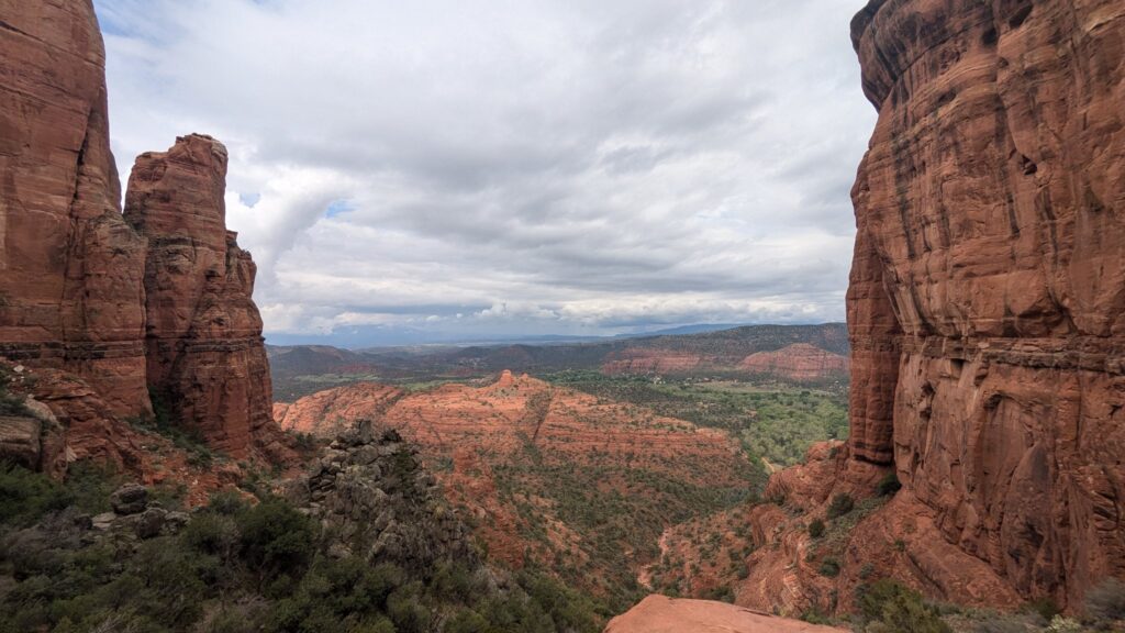
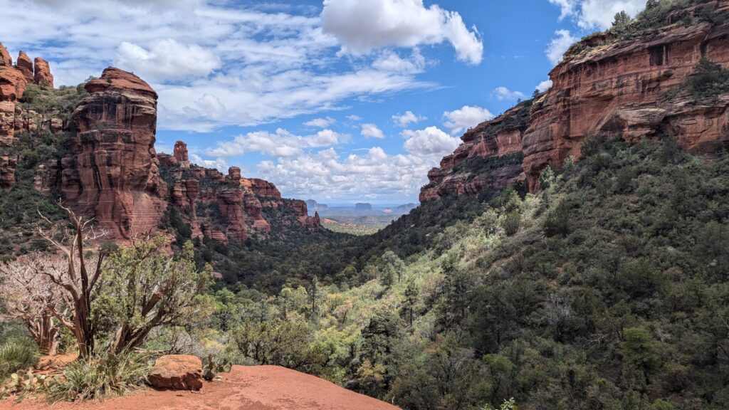
Timings, parking, the Red Rock Pass and how to reach Devil’s Bridge without a 4×4 are all covered in my Sedona guide:
Day 4: West Fork, then back via Route 66 and the Hoover Dam
The morning: West Fork and Oak Creek Vista
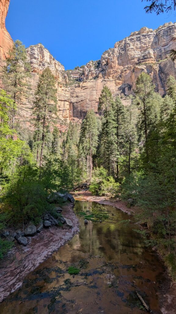
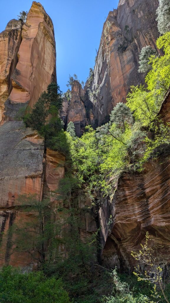
Before heading home, I stopped in Oak Creek Canyon, under half an hour from Flagstaff, for the West Fork trail: a shady trail along a creek you keep crossing, between sandstone walls. I parked around 8:30 am and was back at the car around 11:30. Then, driving back up the 89A switchbacks, one last stop at Oak Creek Vista, around 12:30 pm. The details (separate paid parking, frequent closures) are in my Sedona guide.
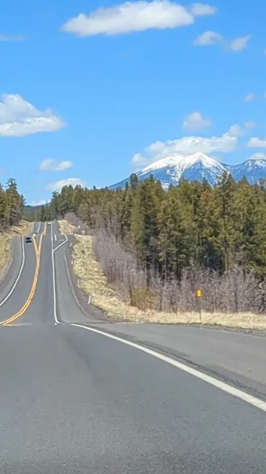
Heading back towards I-40, the road runs through a pine forest, with a peak still covered in snow in the distance in early May. A complete contrast with the day before.
Route 66, from Seligman to Kingman
On the way back, I took Route 66 almost by chance: when I saw the sign at Seligman, I left I-40 to follow the old road all the way to Kingman, before rejoining the main highway. Between these two towns lies the longest surviving stretch of Route 66, about 85 miles (140 km).
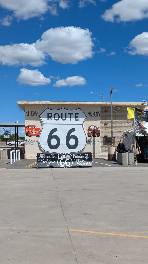
In Seligman, I stopped around 2:25 pm in front of the big “Birthplace of Historic Route 66” sign: a few old cars, characters from the movie Cars painted on the walls, a drink from a convenience store, and I was off again.
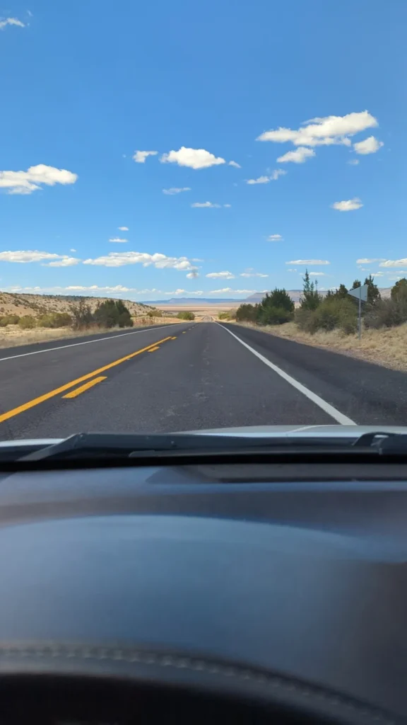
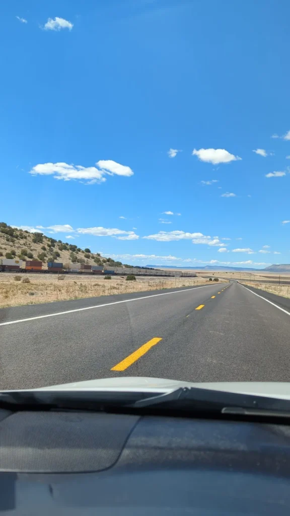
After that, to be honest, I didn’t stop again. At every village, I told myself I’d stop at the next one, but there wasn’t much there, so I kept going. I hadn’t looked into it beforehand, and that’s my advice: if Route 66 interests you, check what there is to see on this stretch before you go, so you know where to stop. Even without stopping, the road is worth the detour in itself: very long straight stretches between dry grassland and mesas, a freight train running alongside, and the old red Burma-Shave signs.
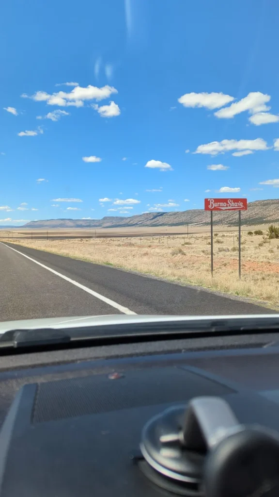
These little red signs have a story. Burma-Shave was an American brand of shaving cream that, from 1926 to 1963, advertised along the roads with series of about six signs spaced out one after the other. Each one carried part of a sentence: as you drove, you read a little rhyme, often funny, sometimes a safety tip, and the last sign gave the brand name. For example: “Drive / With care / Be alive / When you / Arrive / Burma-Shave”. With the interstates and faster cars, the signs became too small to read, and the campaign ended. The ones you’ll see on this stretch of Route 66 are replicas.
What to see on this stretch, if you plan ahead (I didn’t stop at these)
- Seligman: this is where the movement to save Route 66 began in the late 1980s, started by a local barber, Angel Delgadillo. The town lives off Route 66: souvenir shops, old cars and retro signs.
- Grand Canyon Caverns, near Peach Springs: caves about 210 feet (60 m) underground, open to visitors.
- Peach Springs: the capital of the Hualapai reservation.
- Hackberry General Store: a former general store turned small Route 66 museum, with old gas pumps and vintage cars out front.
- Kingman: a Route 66 museum.
The Hoover Dam, on foot
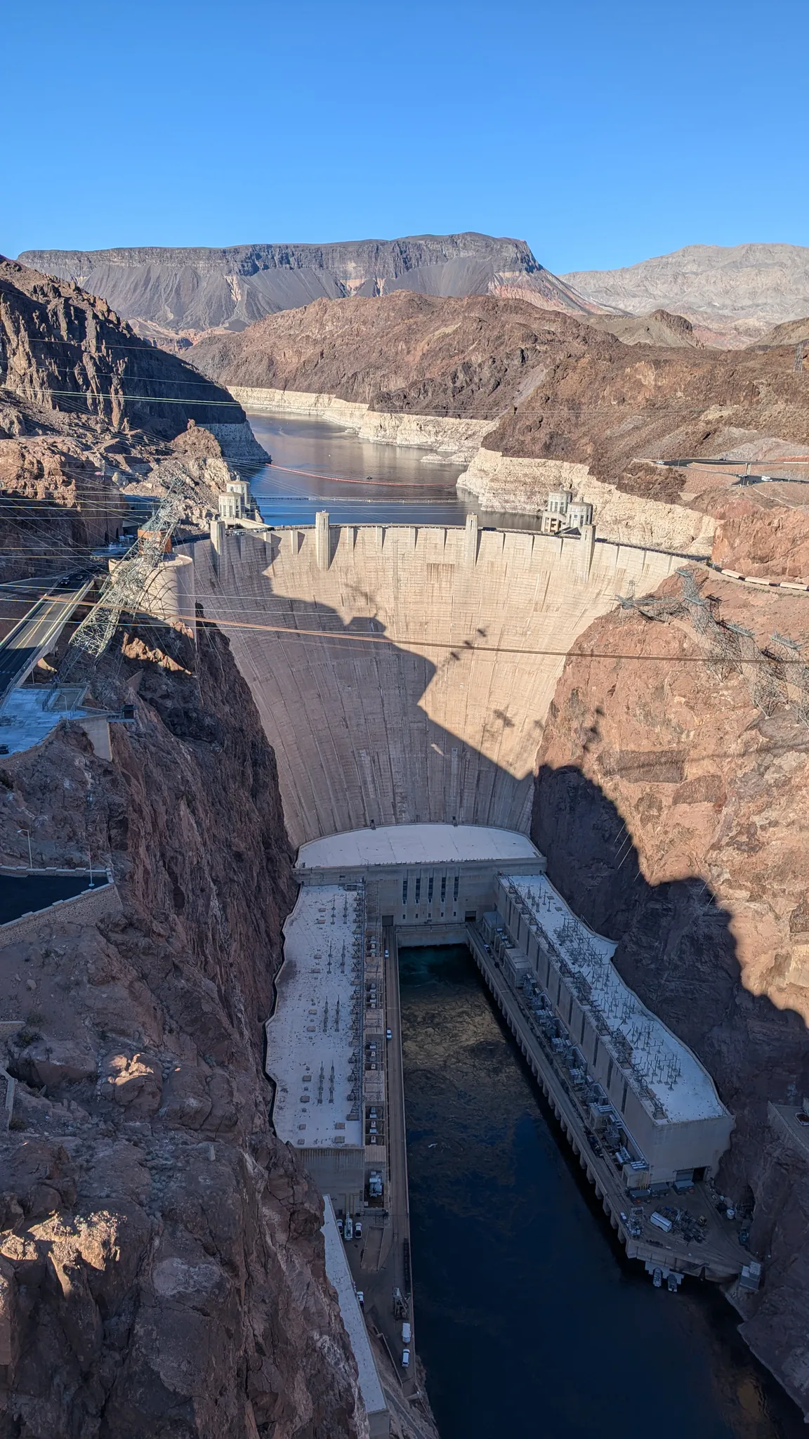
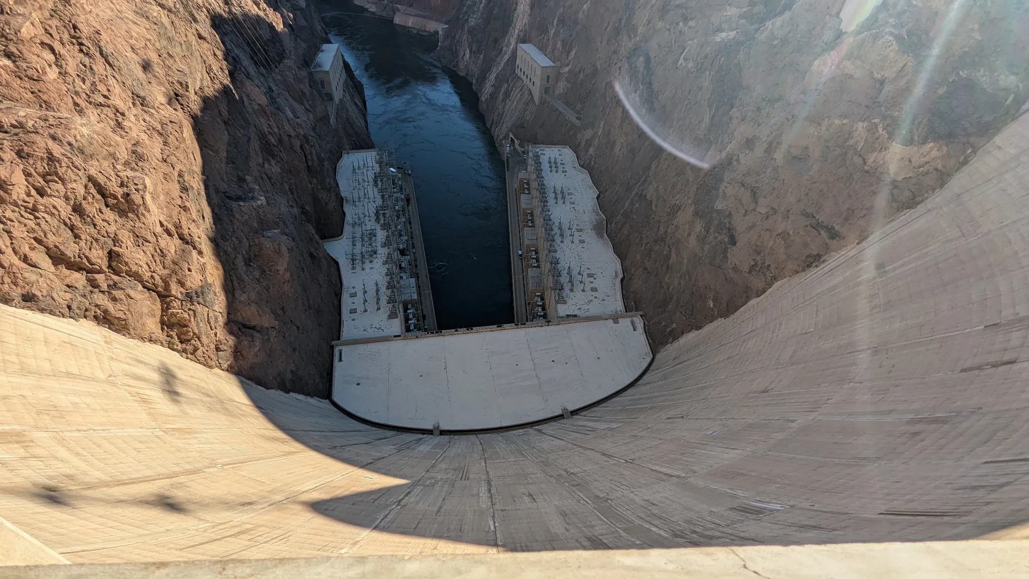
The last stop before Las Vegas, about 40 minutes from the city: the Hoover Dam, which holds back Lake Mead, on the border between Arizona and Nevada. I saw it in two steps, without paying anything:
- from the bridge: I parked at the bridge parking lot (Nevada side), then walked up onto the Mike O’Callaghan–Pat Tillman Memorial Bridge, the big highway bridge, whose dam-side walkway has the best view. I was there around 5:20 pm, in strong heat: I didn’t linger;
- on the dam: I then drove down (too hot to walk down and back up), crossed the dam and parked on the Arizona side, in one of the small free lots along the road going up. I left around 5:45 pm. I think the Visitor Center was already closed.
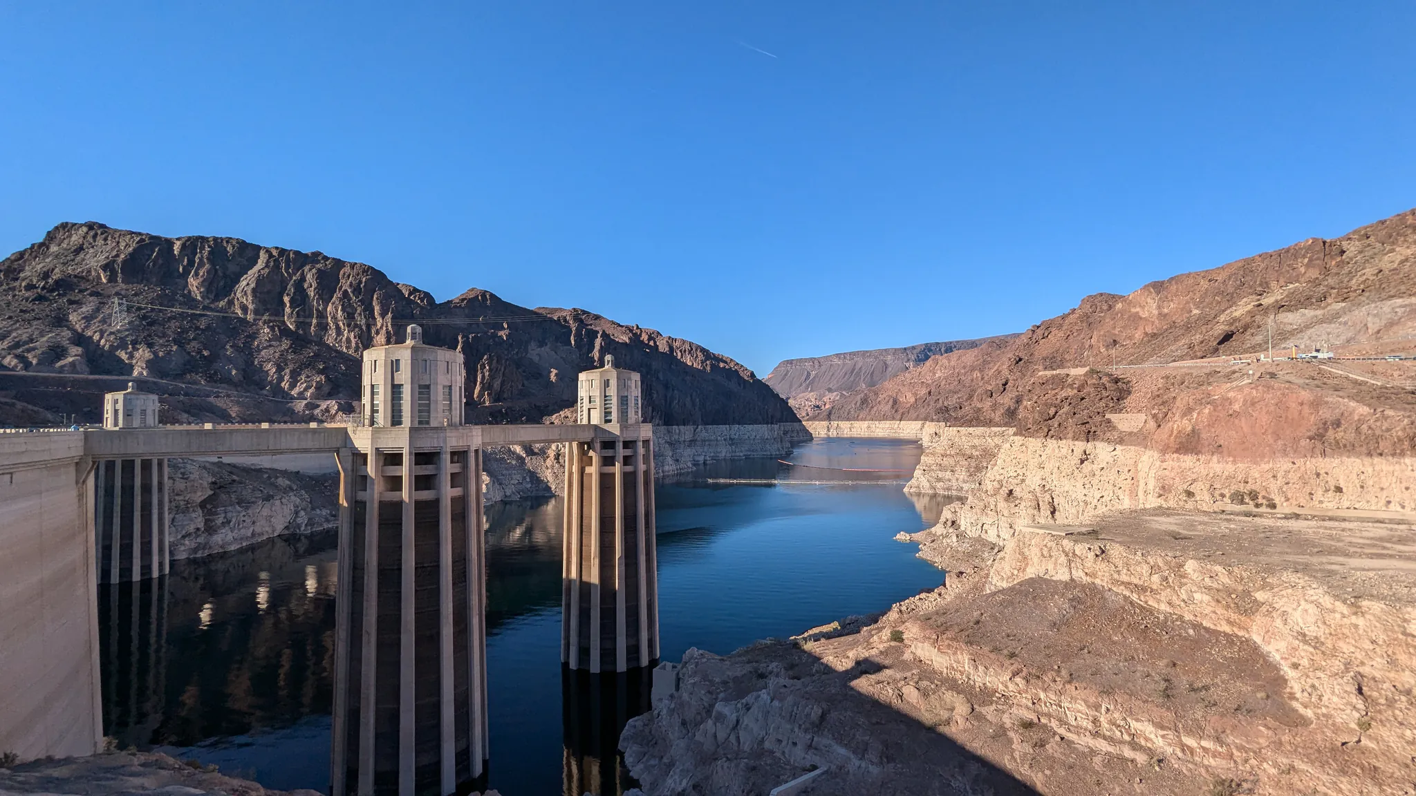
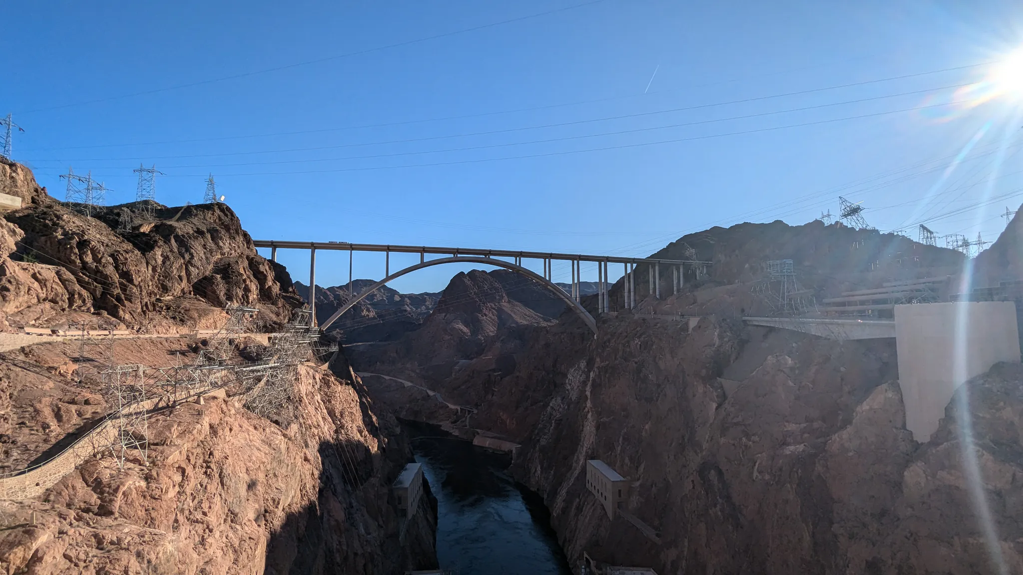
Practical info (Bureau of Reclamation website, October 2026):
- Security checkpoint: the road to the dam leaves US-93 on the Nevada side, and all vehicles may be inspected at the checkpoint. I went through without being stopped. No weapons, fireworks or drones.
- Parking: a lot of about 70 spaces near the bridge, on the Nevada side, with stairs up to the walkway; a parking garage on the Nevada side ($10); on the Arizona side, the first lot after the dam is paid ($10), the ones further up the road are free. The road ends in parking lots on the Arizona side: you come back the same way.
- Walking on the dam and the bridge is free. Only the guided tours inside are paid, and the national parks pass isn’t accepted there.
- Heat: there’s hardly any shade. Bring water, especially if you park in the free lots, further from the dam.
- Closures: access to the dam sometimes closes for repairs (for a few days in July 2026, for example). Check before you make the detour.
Visiting Hoover Dam (Bureau of Reclamation)
Back in Las Vegas around 7 pm.
Where to stay: Williams, then Flagstaff
The hotels inside the park and in Sedona are expensive. I chose to stay a little further away, for much less, picking a town on the next day’s route each night.
Night 1, in Williams: about 1 hour 10 minutes’ drive from the park, but much lower prices. I stayed at the Howard Johnson by Wyndham Williams, $48 (€42) a night in May 2025, booked on Booking.com. Pretty decent for the price and fairly clean; a simple breakfast that didn’t leave much of an impression (waffles, bread…).
Nights 2 and 3, in Flagstaff: about 1 hour 25 minutes from the Desert View Watchtower and 1 hour from Sedona, it’s the ideal base for the end of the trip. I stayed at the West Inn NAU (Downtown Flagstaff), $129 (€115) for two nights, booked on Booking.com. To be clear: it’s more of a motel, less clean, with fairly thin walls and no breakfast. But for the price, it does the job, and there was a microwave in the room: a ready meal from a convenience store, and dinner was sorted.
Other options (I haven’t tried them):
- inside the park, in Grand Canyon Village: hotels and lodges just past the entrance, as close as it gets to the trails, but at much higher prices;
- on the road between Williams and the park: hotels and campgrounds in Red Lake, Valle and especially Tusayan, a few miles from the South Entrance;
- in Sedona, to wake up surrounded by red rocks, on a bigger budget.
For food, I didn’t look for restaurants: McDonald’s the first night, then convenience stores along the way, for hiking picnics as well as dinners.
Car, gas and the time in Arizona
The car
You need one: there’s no practical public transport for this loop. I borrowed a friend’s car: mine, a used car bought in Las Vegas, had broken down a few months earlier. If you fly into Las Vegas, renting a car at the airport leaves you free to set your own schedule. A regular car is fine for the whole itinerary, including Sedona (see my Sedona guide for Devil’s Bridge).
Driving: the roads are pleasant, with little traffic outside Las Vegas. One surprise: speed limits aren’t always respected, and trucks overtook me while I was driving at the limit. Go at your own pace.
Gas
I didn’t keep track of the amount, but I filled up twice over the four days, in Arizona. For a sedan like the one I drove (a Toyota Camry), expect about a hundred dollars of gas for the loop, depending on fuel prices (an estimate based on May 2025 prices). To be safe, fill up in Williams or Flagstaff before the long stretches, such as Route 66 on the way back.
The time: Arizona’s trap
Arizona doesn’t observe daylight saving time. As a result, from spring to fall, the Grand Canyon, Flagstaff and Sedona are on the same time as Las Vegas. In winter, Arizona is one hour ahead of Nevada.
But there’s an exception: the Navajo Nation, the large Navajo territory in northeastern Arizona, does observe daylight saving time. From March to November, it’s therefore one hour ahead of the rest of Arizona. And the road between the park’s east exit (Desert View), Cameron and Flagstaff runs through Navajo land. That’s what happened to me: I didn’t know, and my phone changed time on the way. At the Hoover Dam, straddling Nevada and Arizona, it hesitated too. If you have a set time to keep, go by the local time where you’re heading, not by your phone.
Time in Arizona and the Navajo Nation (timeanddate.com)
Passes and fees: how much does it cost?
The Grand Canyon is the only national park on the loop. Entry costs $35 per car for 7 days. Since 1 January 2026, visitors who aren’t US residents pay an extra $100 per person aged 16 and over, unless they have an annual pass.
The America the Beautiful pass costs $80 for US residents (that’s the one I had, as a Las Vegas resident) and $250 for non-residents, covering the whole car for 12 months. It also covers most trailhead parking in Sedona, instead of the Red Rock Pass.
The math for this loop, if you’re visiting from abroad: for two people without a pass, expect about $240 ($35 entry to the Grand Canyon, 2 × $100 surcharge and a $5 Red Rock Pass in Sedona). With the non-resident pass, $250: about the same. The pass becomes worth it from three adults, or if you add another big park subject to the surcharge, such as Zion or Bryce Canyon. Death Valley, which I visited from Las Vegas in March 2025, isn’t subject to this surcharge, but the pass also covers its entrance fee: if you add it to your trip, that’s one more entry fee to factor in.
If you’re a US resident, the calculation is simpler: no surcharge, and the $80 pass pays for itself quickly if you visit a few national parks in the year. Full fee details are here:
South Kaibab Trail: how much is the entrance fee?
Paid separately, pass or no pass:
- the West Fork trailhead parking ($15 per car), which accepts neither the pass nor the Red Rock Pass (all the details in my Sedona guide);
- Valley of Fire, if you add it: it’s a state park, and the pass isn’t accepted (see my guide Valley of Fire in one day);
- at the Hoover Dam, only the parking garage and the guided tours: walking on the dam and the bridge is free.
When to do this road trip
Early May was really pleasant, with big swings you need to pack for: almost cold in the morning at the top of the Grand Canyon (the start of the trail was in the clouds), a peak still covered in snow near Flagstaff, then strong heat at the Hoover Dam in the late afternoon. A light jacket and long sleeves for the sun were all I needed.
Spring (March to May) and fall (September–October) are the best times, and also the busiest. In summer, the heat becomes brutal in the desert, at the Hoover Dam and on Sedona’s exposed trails: start early in the morning. It’s also wildfire and storm season, which sometimes closes roads and trails. In winter, snow is possible at the Grand Canyon and in Flagstaff, at altitude. Whatever the season, check the alerts for the places you’re visiting right before you go.
Variations, if you have more time
- Add Valley of Fire: about an hour northeast of Las Vegas, it’s the perfect day trip the day before or after the loop, with its red rocks and the Fire Wave.
Valley of Fire One-Day Itinerary from Las Vegas
- Drive Route 66 on the way there: leaving Las Vegas early, you could take time to stop at Hackberry or the Grand Canyon Caverns, then Seligman, before reaching Williams. I didn’t do it: it’s an idea if that stretch appeals to you more than I-40.
- Take the train to the Grand Canyon: the Grand Canyon Railway leaves Williams in the morning (9:30 am most of the year) and reaches the South Rim in 2 hours 15 minutes, with just over 3 hours there before heading back, according to the company. I didn’t take it: it’s an option for a day without driving, but without a car in the park, you won’t do Desert View Drive.
- Watch out for Grand Canyon West: if you see “Grand Canyon” tours from Las Vegas with a 2.5-hour drive, they usually go to Grand Canyon West and its Skywalk, which aren’t part of the national park. It’s not the same place as the South Rim on this itinerary: I explain it in my guide to the South Kaibab Trail.
In short
In four days from Las Vegas, this loop takes you to the rim of the Grand Canyon and down into it, among the red rocks of Sedona, into the shade of Oak Creek Canyon, then along Route 66 and to the Hoover Dam. Stay in Williams then Flagstaff to keep the budget reasonable, plan on about 905 miles (1,460 km) of driving and around 27 miles (43 km) of walking, and if you can, add a day at the Grand Canyon and one or two in Sedona. And look into Route 66 before you go: had I known, I’d have done my homework, just to know where to stop.
To round off your trip:
- South Kaibab Trail to Skeleton Point: A Grand Canyon South Rim Day Hike (and the Viewpoints to Add)
- Sedona One-Day Itinerary: Cathedral Rock, Fay Canyon and Devil’s Bridge (Plus West Fork in Oak Creek Canyon)
- Valley of Fire One-Day Itinerary from Las Vegas: Fire Wave, White Domes, Rainbow Vista and Mouse’s Tank Road